IWEM: CONFERENCE 1991
A Paper Presented at the Annual Conference of the IWEM at Birmingham in April 1991
THE ENVIRONMENTAL IMPACTS OF MAHAWELI RIVER ENGINEERING AND RESERVOIR CONSTRUCTION PROJECT
By
A.D.MOONASINGHA. B.Sc (Hons), M.Eng. (Graduate)
INTRODUCTION
The Mahaweli Ganga (River) rises above an altitude of 1200m on the Hatton plateau of the westerly central hills of Sri Lanka, flows in northern and easterly directions winding its way around Kandy the historic hill capital, following few rapids to the east, flows through the low lying coastal plains of the eastern dry zone, and enters the Indian Ocean at Trincomalee on the north eastern coast (Fig 1). The Mahaweli Ganga, the longest in Sri Lanka, is 206 miles long and discharges an annual flow of some 7900 million cubic meters [1].
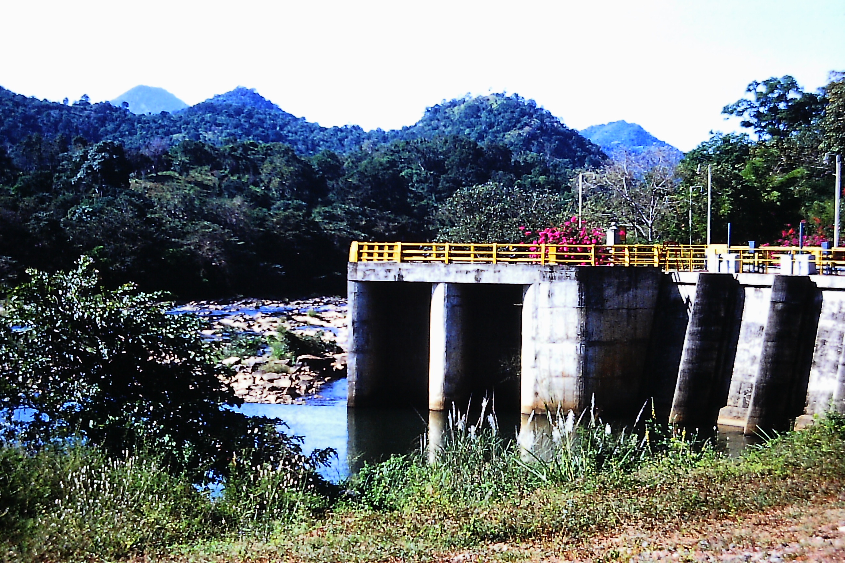
The construction of the Mahaweli Project initially commenced in 1970 with the interbasin transfer diversion headworks at Polgolla near Kandy [1,2]. The Polgolla complex comprising a barrage, tunnel and a hydropower station at Ukuwela, was completed in 1976. This early programme of construction under the phase 1, stage 1 also included a hydropower station at Bowatenna in the Amban Ganga basin – a tributary of Mahaweli River which is was commissioned in 1981. This complex also transfers water for irrigation in the North central Province.
The original master plan of the Mahaweli Project was for completion in 30 years, but in 1977, driven by the political exigency to meet the growing socio-economic and power supply needs of the country, led to the accelerated implementation of the remaining major phase of the project, with bilateral and multilateral aid. This constituted the construction of four major reservoirs and three hydropower stations which saw the completion and commissioning during the period 1981 – 1990. The accelerated programme also encompasses most of major irrigation settlement systems in which the settlement is Lanka nearing completion [4]. The Mahaweli Development Project irrigates some 100,000 ha of land in the dry zone, including enhancement of irrigation supplies to over 53,420 ha of existing irrigation lands: and has the capacity to generate 2 million megawatt hours of hydroelectric energy per year. The (Figs 2 and 2a) illustrate the Mahaweli interbasin transfer water distribution network system.
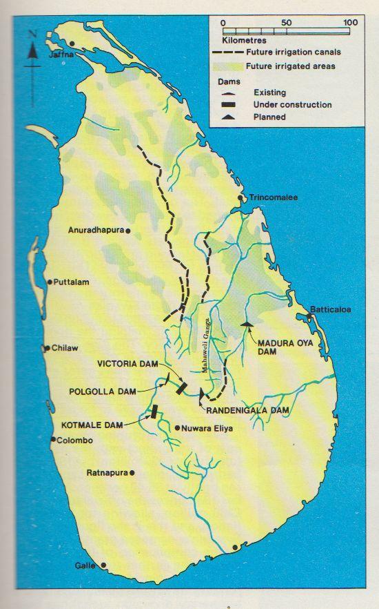
Fig 1. Mahaweli River Dam Projects, Sri Lanka
ACCELERATED MAHAWELI PROGRAMME
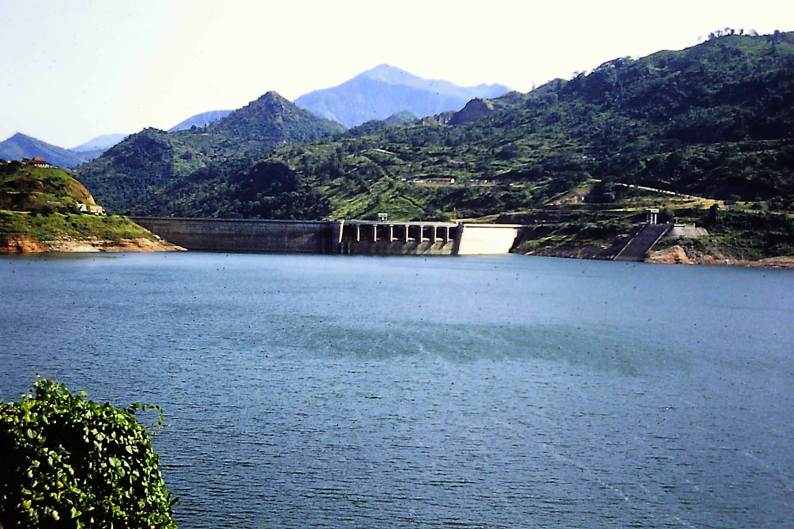
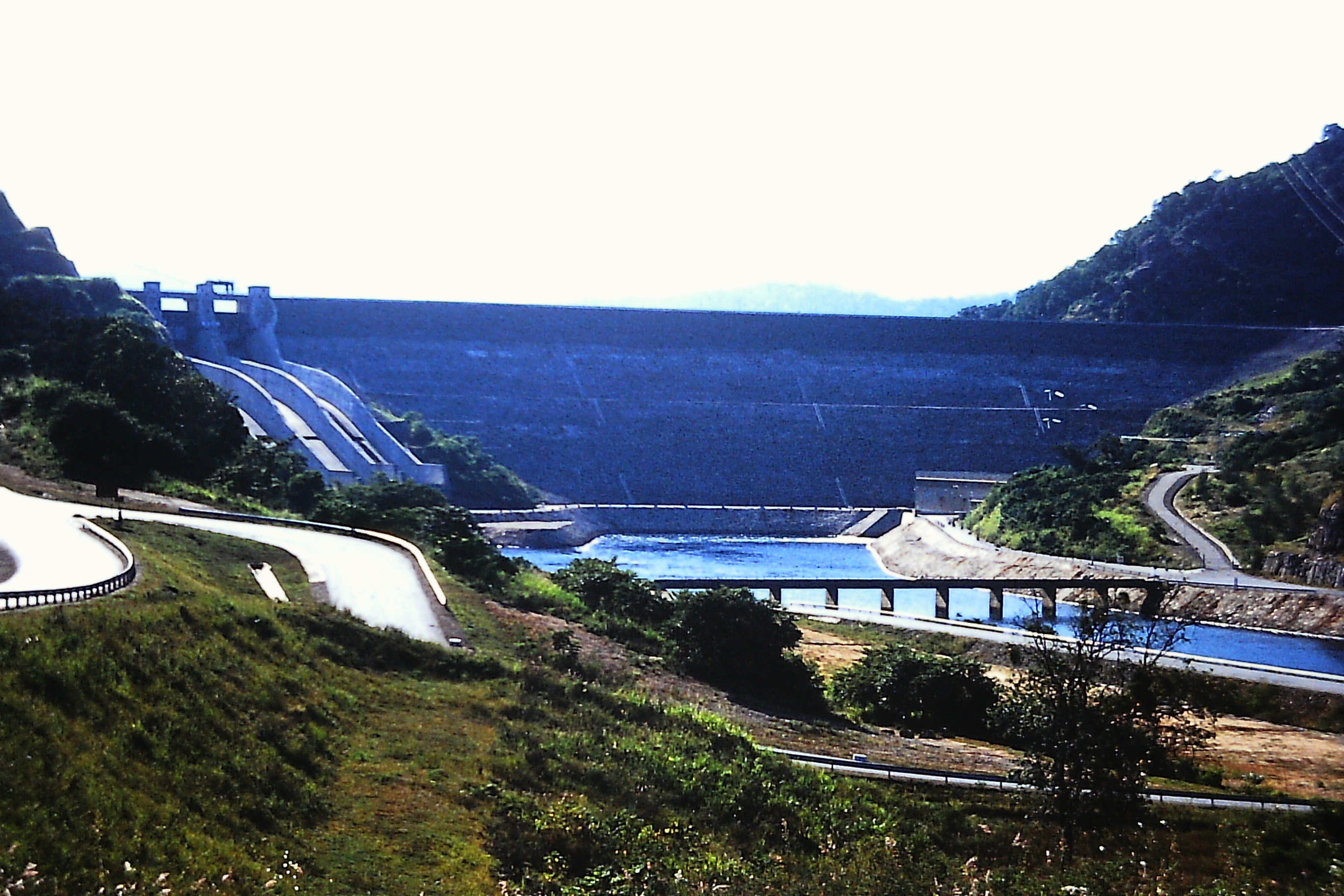
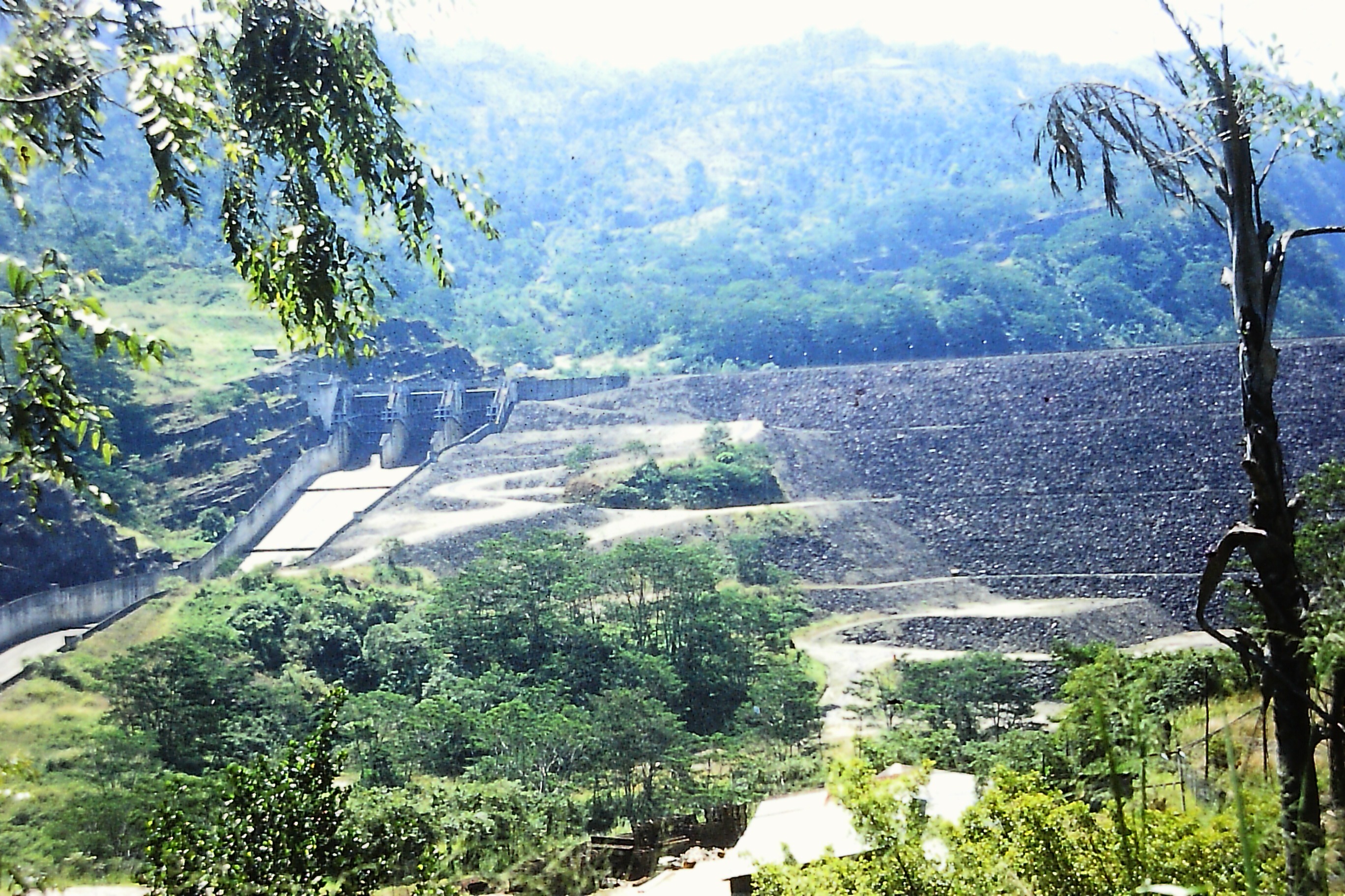
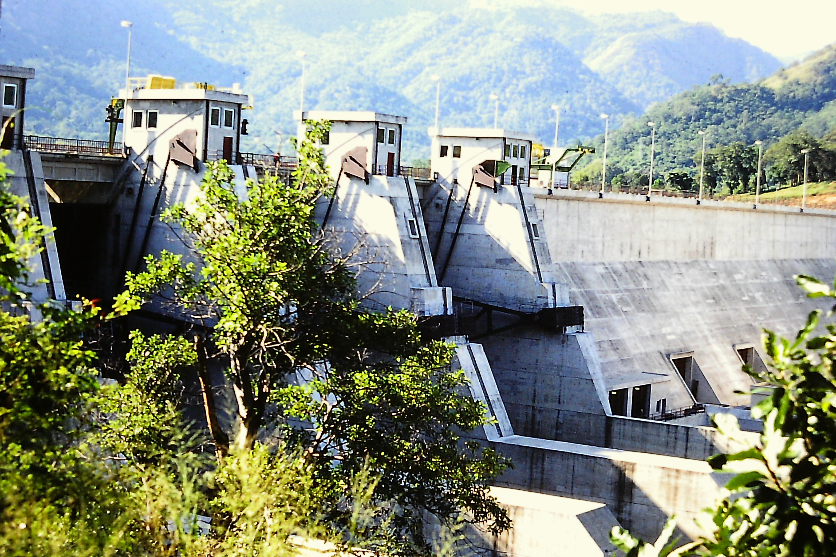
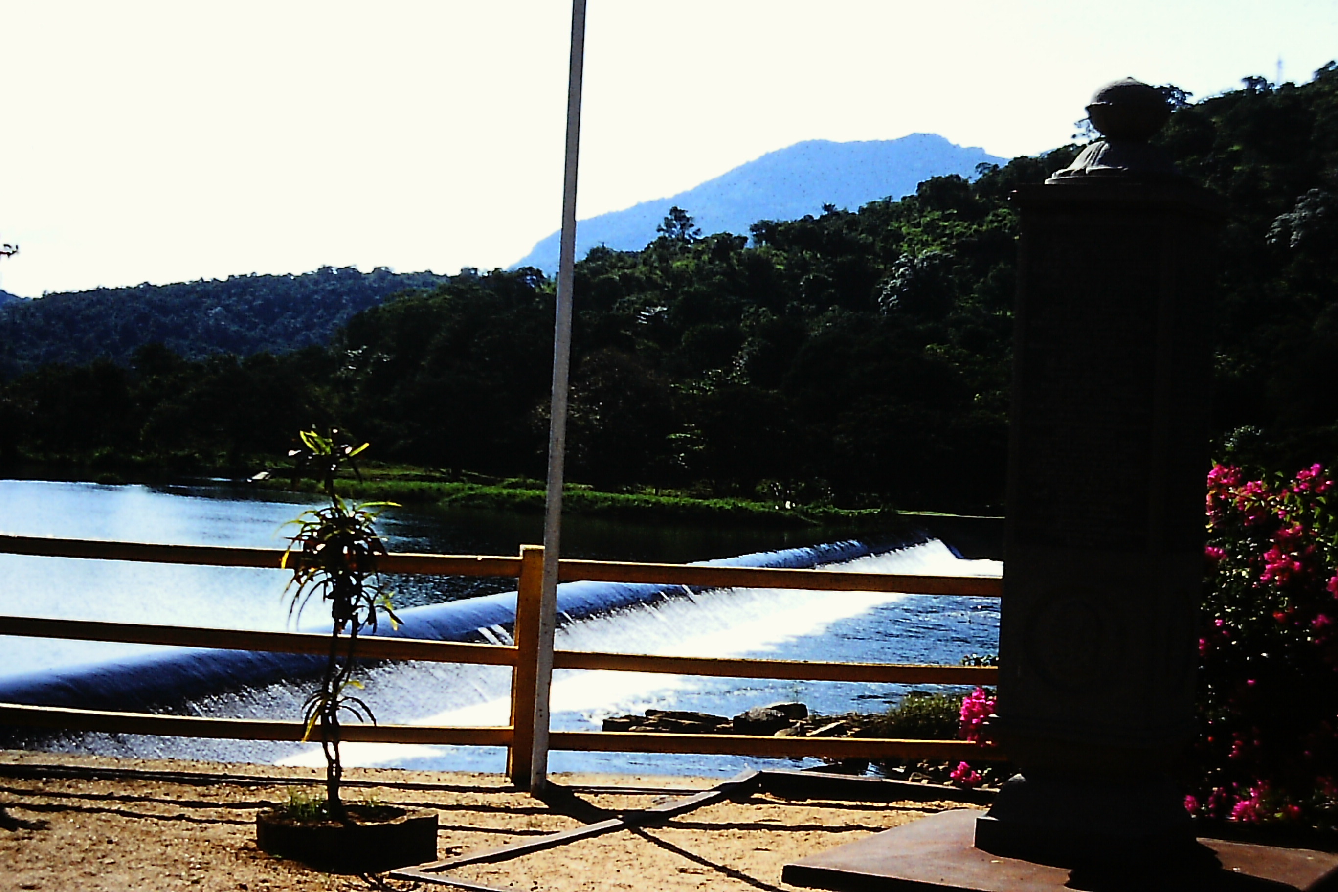
This major phase of the Mahaweli Project comprised the construction of major Dams and headworks, namely Kotmale, Victoria, Randenigala, and Rantambe, illustrated in (Fig 1) [5]. Kotmale Project the most upstream of the Mahaweli cascade is located on the Kotmale Oya, a tributary of Mahaweli Ganga (Fig 3). The Kotmale Project has posed both serious geological and financial problems of construction, and consists of a rockfill dam incorporating a reinforced concrete face [1,5,6]. The Victoria Project is located on the Mahaweli Ganga approximately fourteen miles downstream of the Polgolla Barrage, and consists of a double curvature concrete arch dam. Below Victoria is the Mahaweli’s biggest reservoir, Randenigala comprising a rockfill dam with clay core. Downstream of Randenigala is the medium sized Rantambe Project, the last of the reservoirs on the Mahaweli cascade which was completed in 1990 [3]. The Maduru Oya Project is another major reservoir in the Mahaweli Accelerated Programme, located on the Maduru Oya basin in the Eastern Province adjacent to the lower Mahaweli catchment [1,4]. The completion of irrigation settlement Systems B,C and G of the downstream developments are operations of the Accelerated Programme [1].
Fig 2a. Topographic Map of Sri Lanka
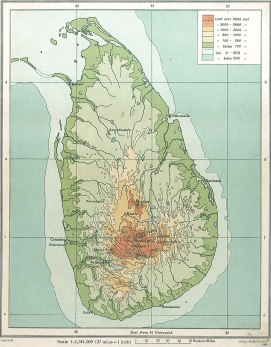
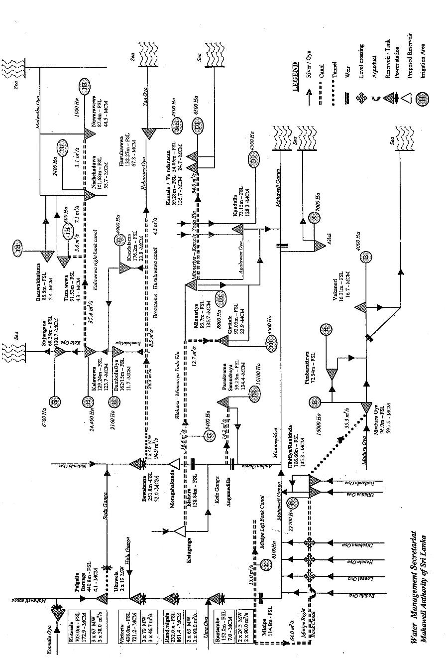
Fig 2. Mahaweli Water Distribution Network
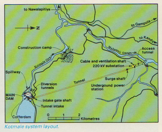
Fig 3. Kotmale Hydropower Project Layout
DAM GEOLOGY
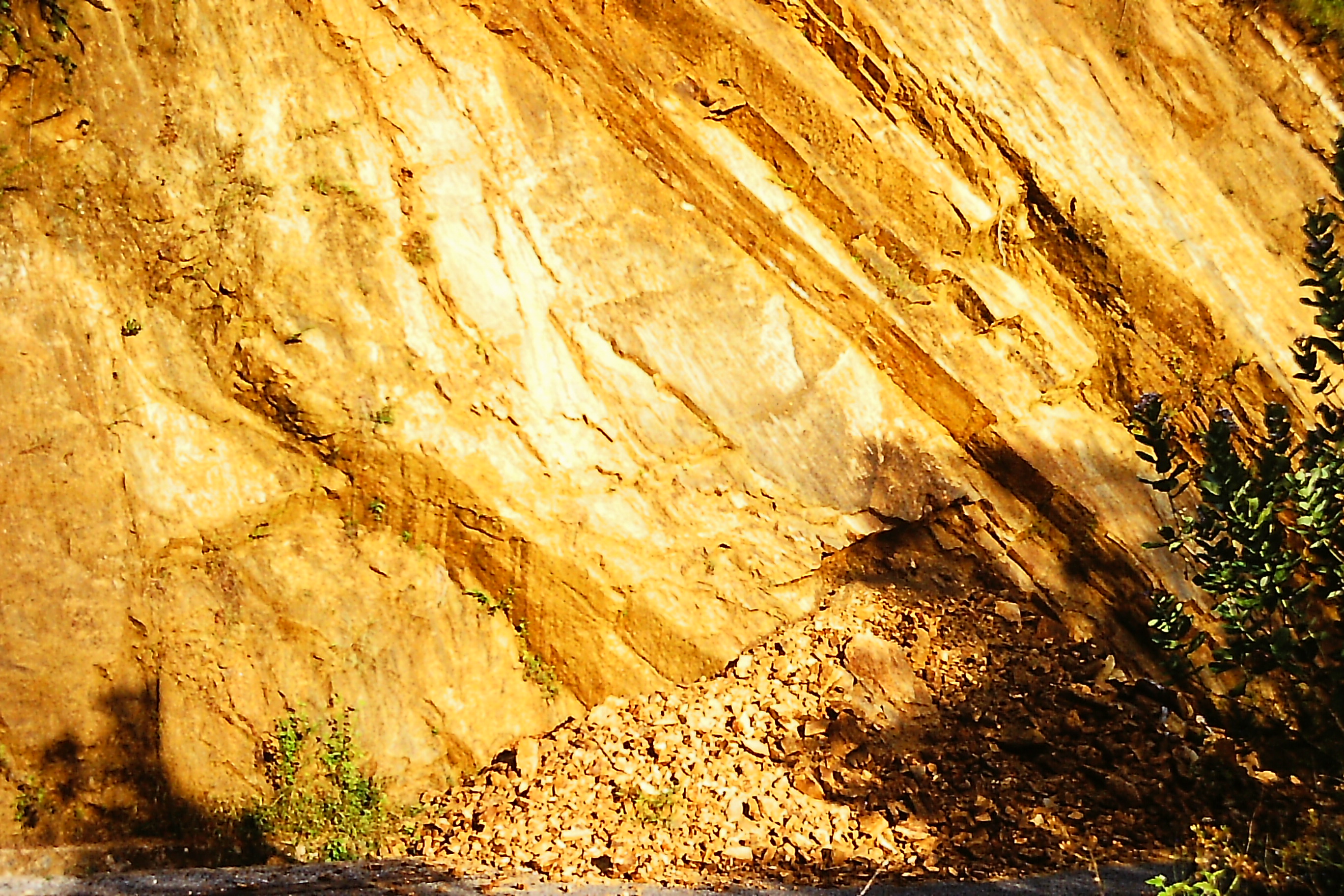
The geology of Mahaweli Ganga dam sites primarily consists of metamorphic rocks of PreCambrian age [7,8]. However, Mahaweli dam sites are also associated with Karst geological features. The site investigations have revealed that rock strata underlying Kotmale dam comprise cavernous limestone beds with widened joints dipping downstream, and weak charnockites with an orientation of foliation shear. These geological weaknesses led to the shifting of Kotmale dam to a position 200m downstream from the original location which contributed to the increased cost and subsequent reduction of dam height with reduced capacity from its potential [5,7]. Limestone caverns were also encountered during the construction of the foundations of the Victoria arch dam project.
Sri Lanka is considered to be an area of low seismicity [8,9]. Cases of too rapid filling behind dams 90m or more high inducing seismicity have been cited [5]. On account of the above and the large size of the dams of Kotmale, Victoria and Randenigala, and the presence of well developed major lineaments in and around these projects, a micro-seismic network was installed in 1982 to measure any increase in seismic activity during and after impounding of the reservoirs. No such increase in seismicity along the lineaments has been observed [8]. During the period of monitoring, clusters of seismic events of less than Richter scale 2 have been recorded in the major reservoir region in the hills of the Mahaweli upper catchment, and in the System B and C areas beside Maduru Oya region in the Eastern Province [9].
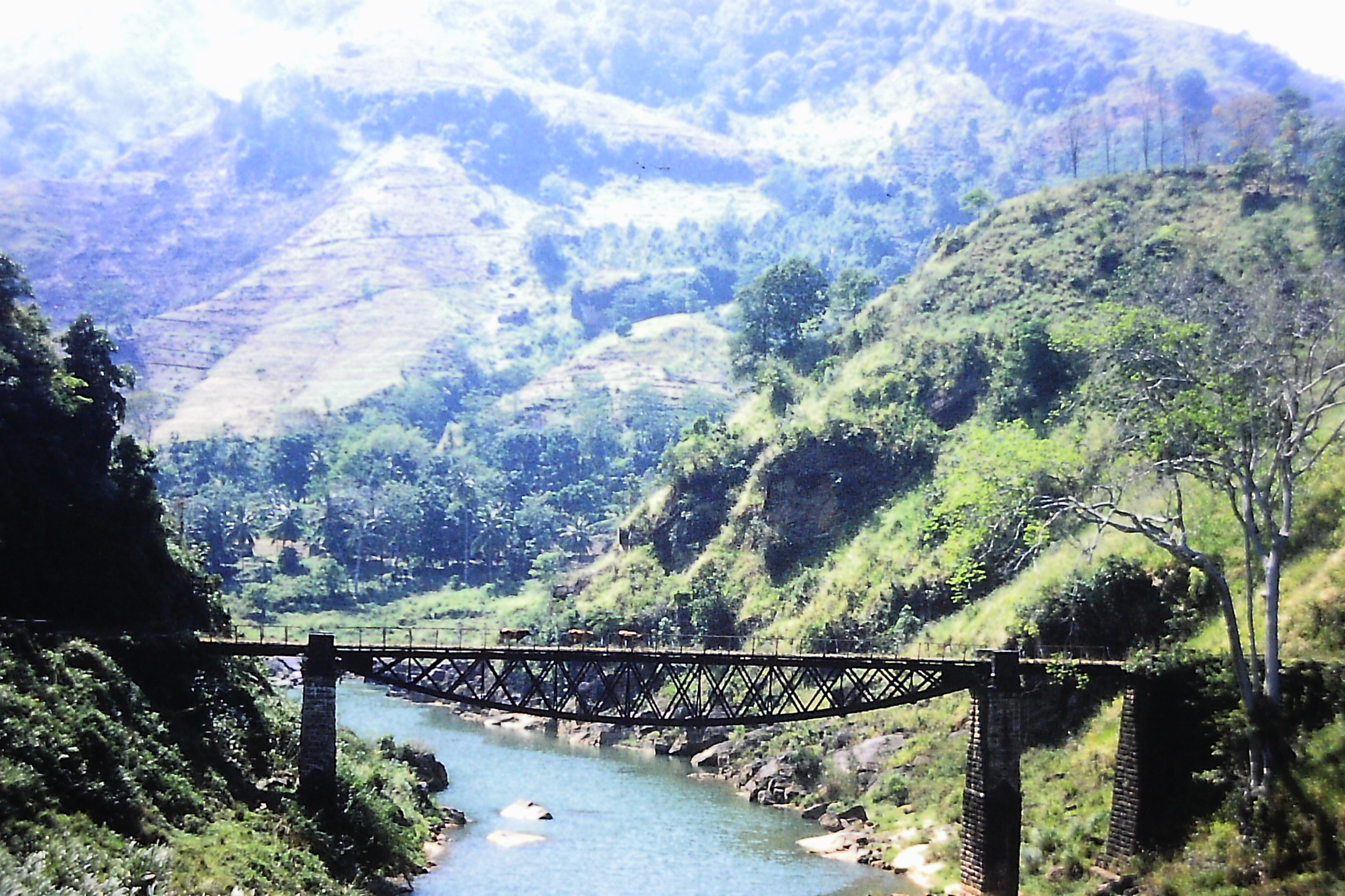
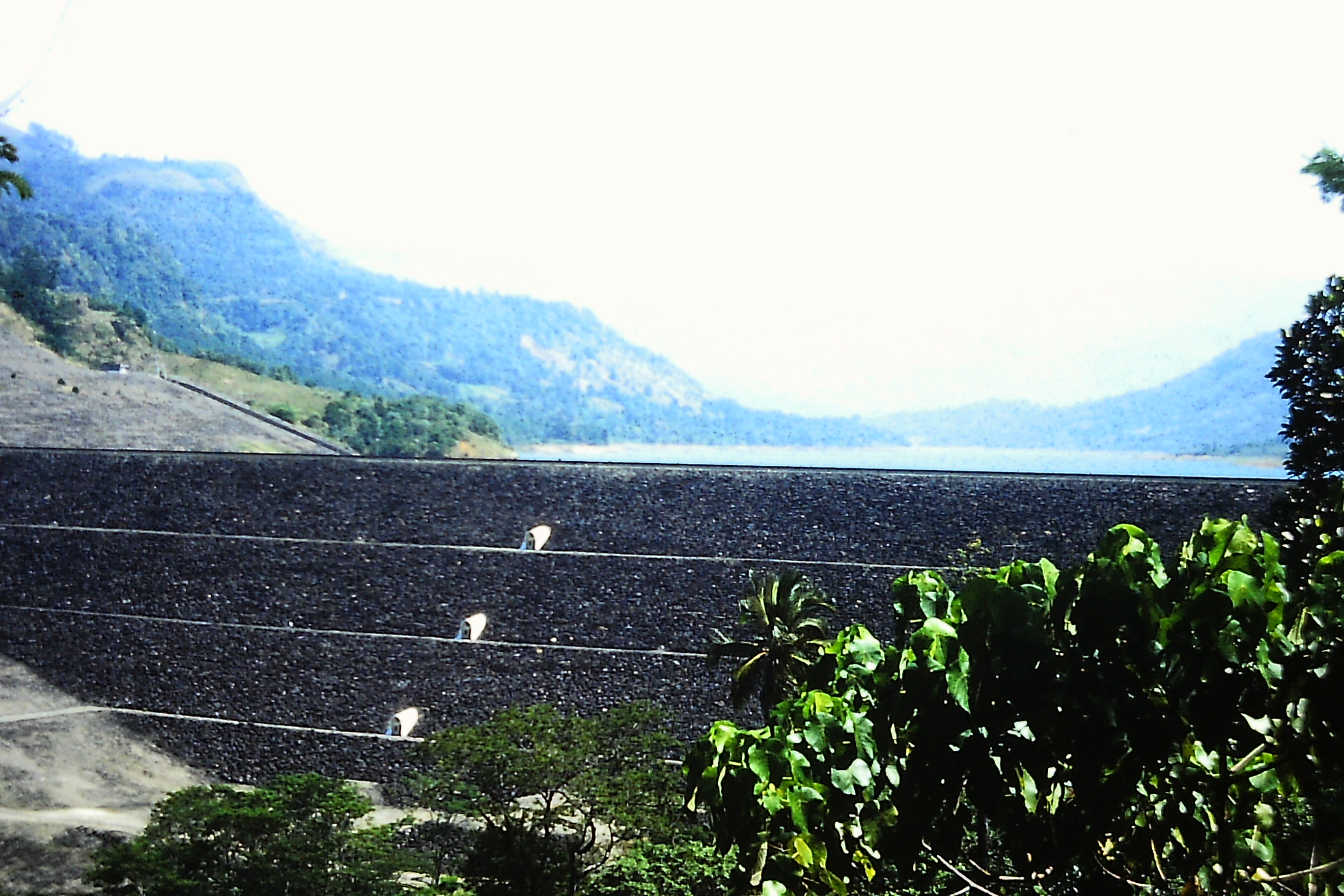
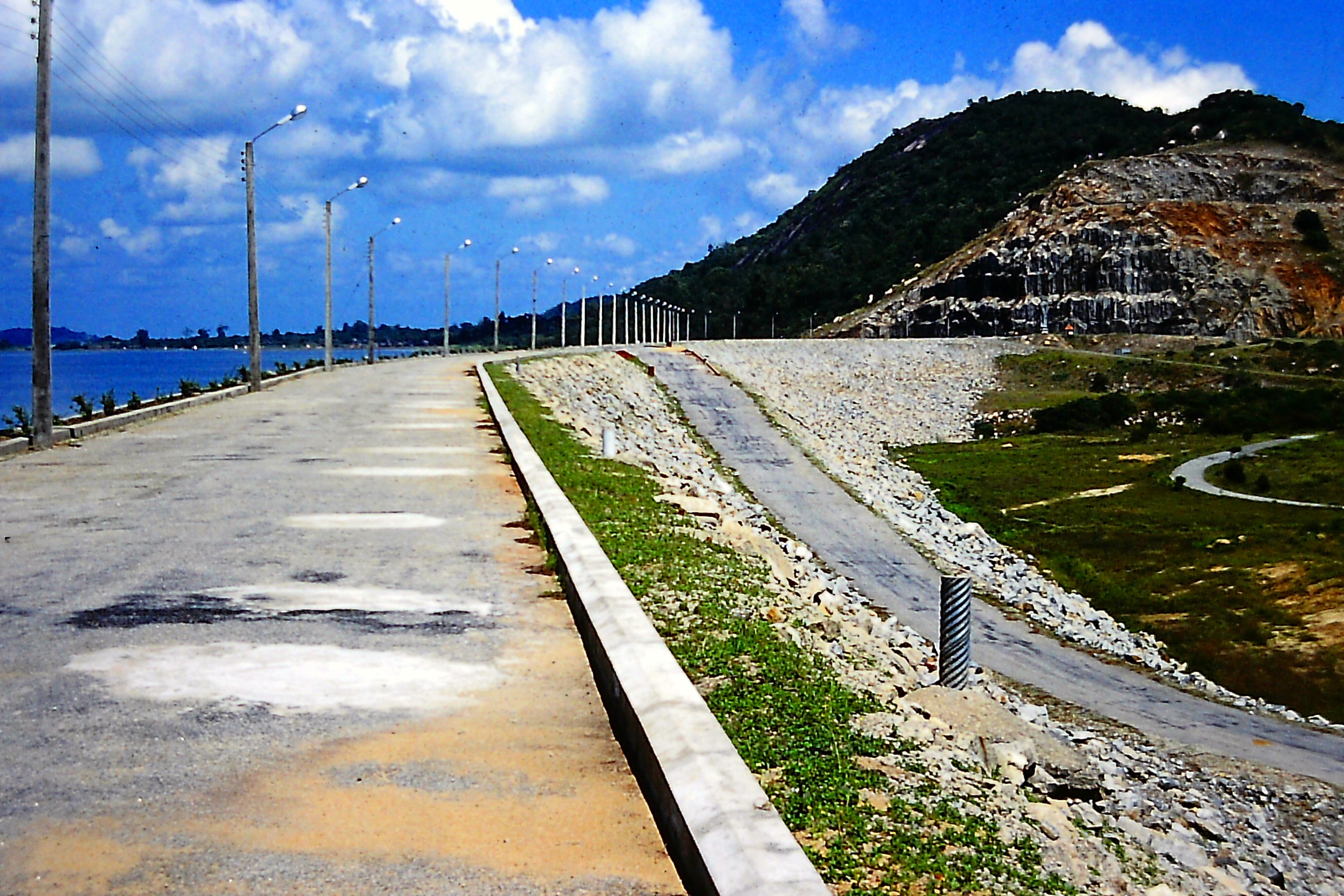
Kotmale Oya, Kotmale Dam, Power Station Tailrace
Fig 3a. Kotmale (Concrete Faced Rock-fill) Dam - Environment
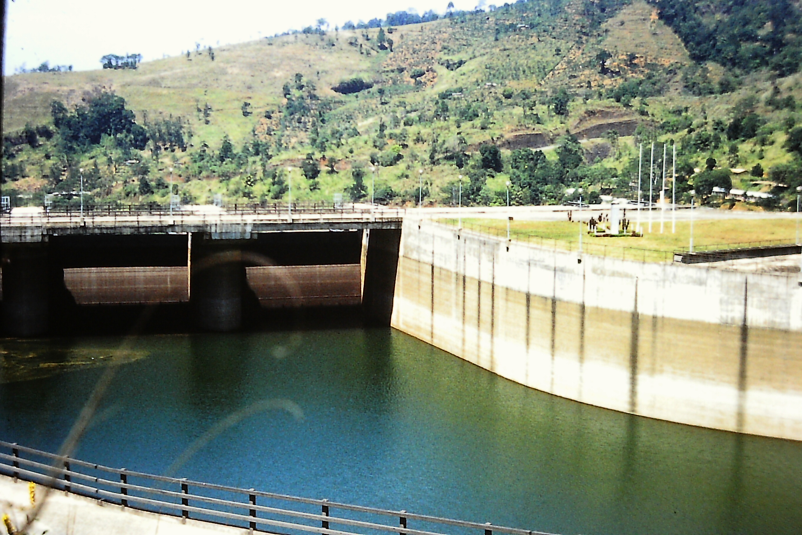
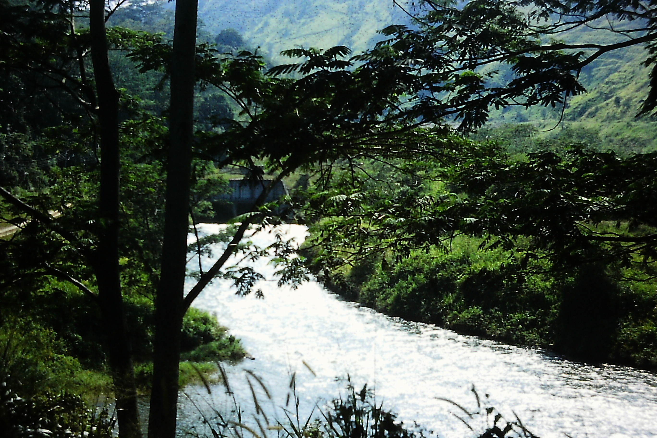
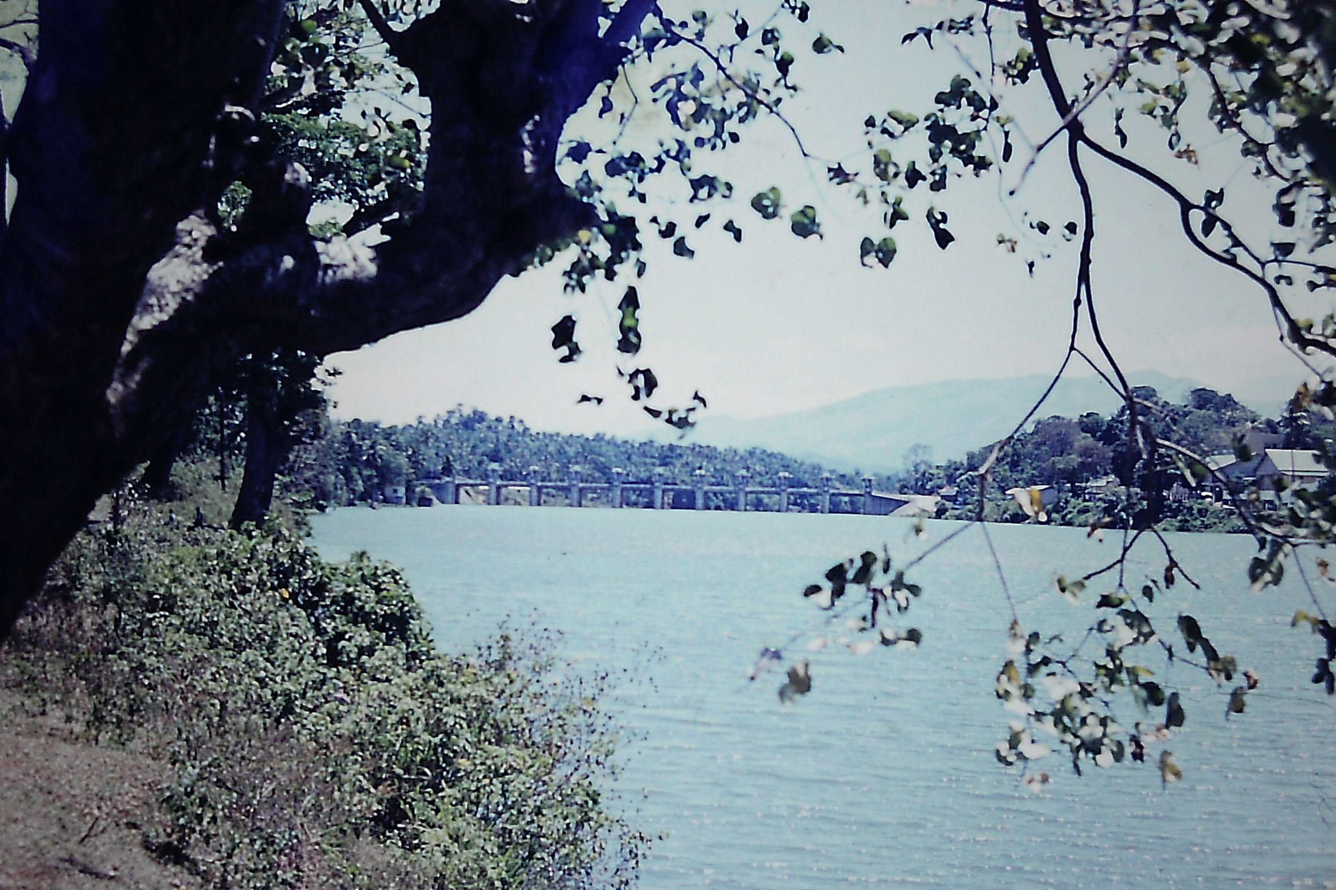
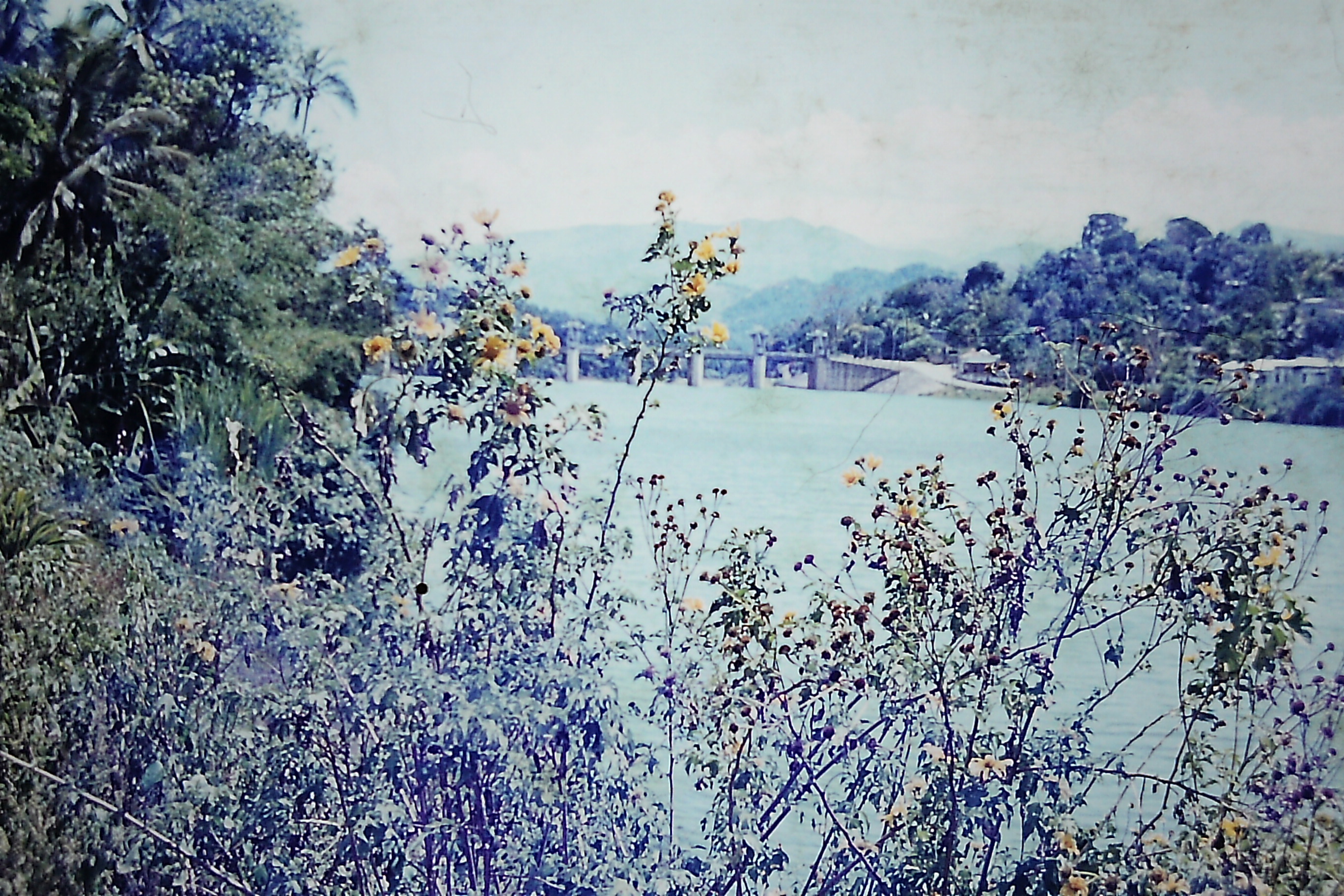
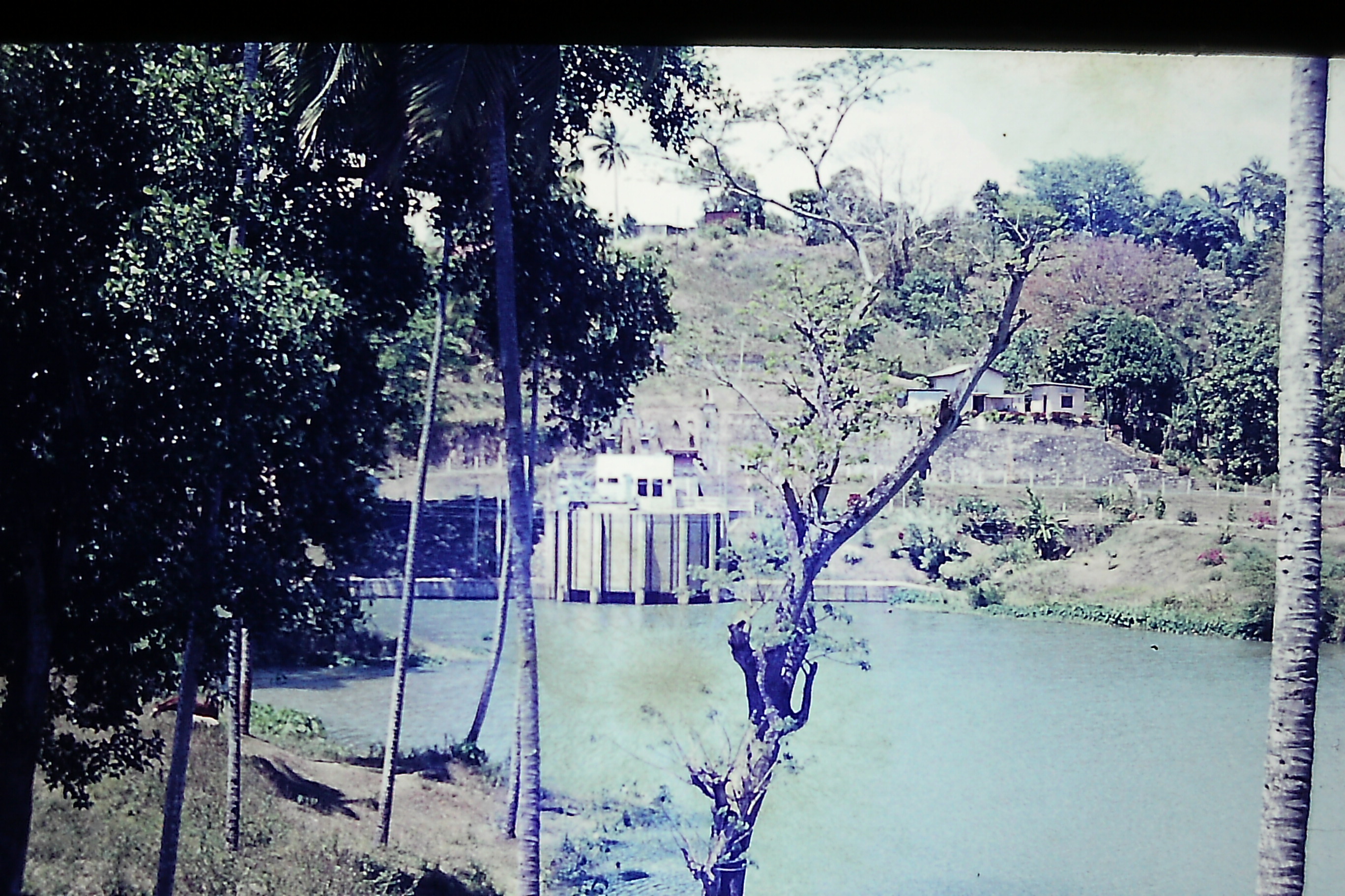
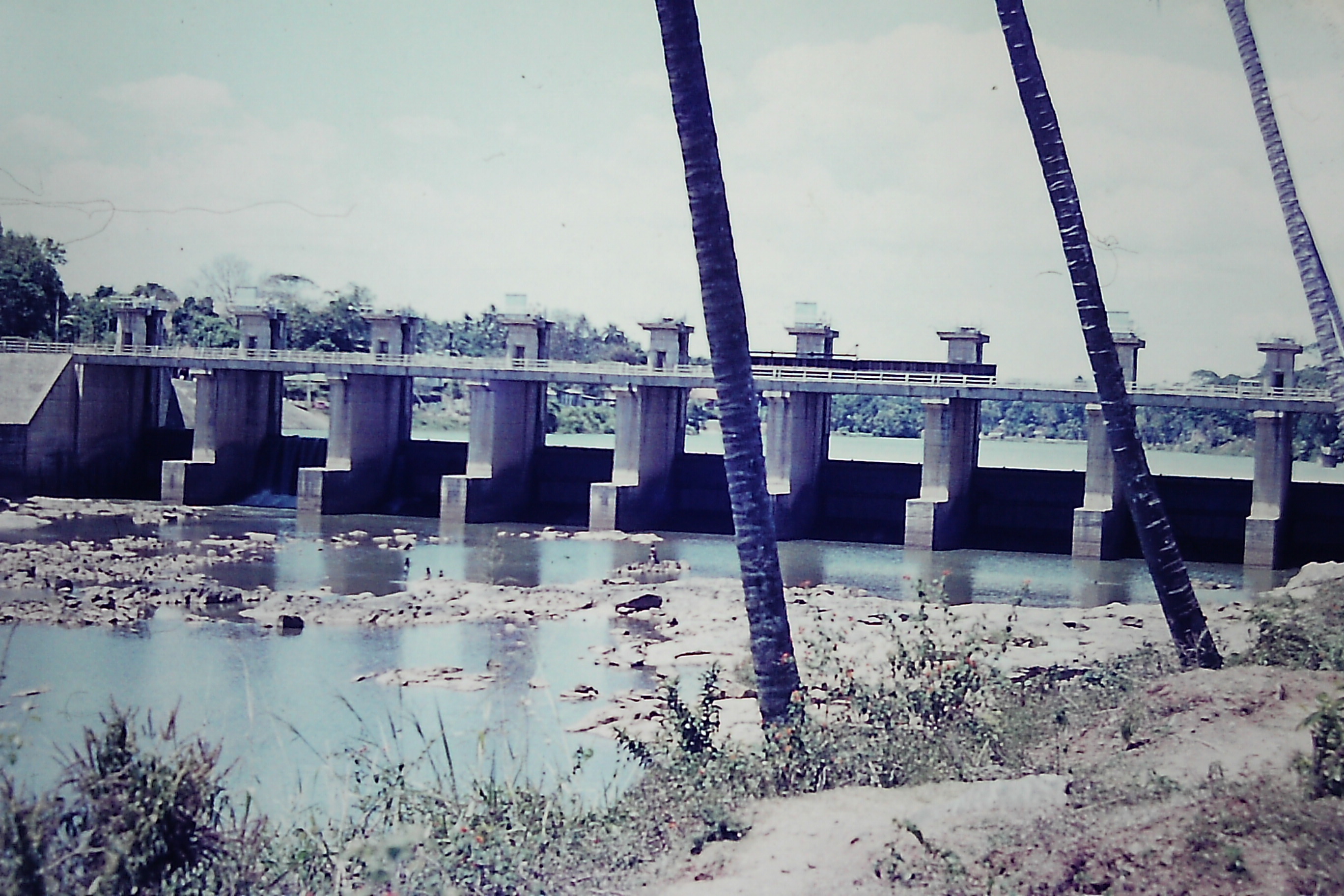
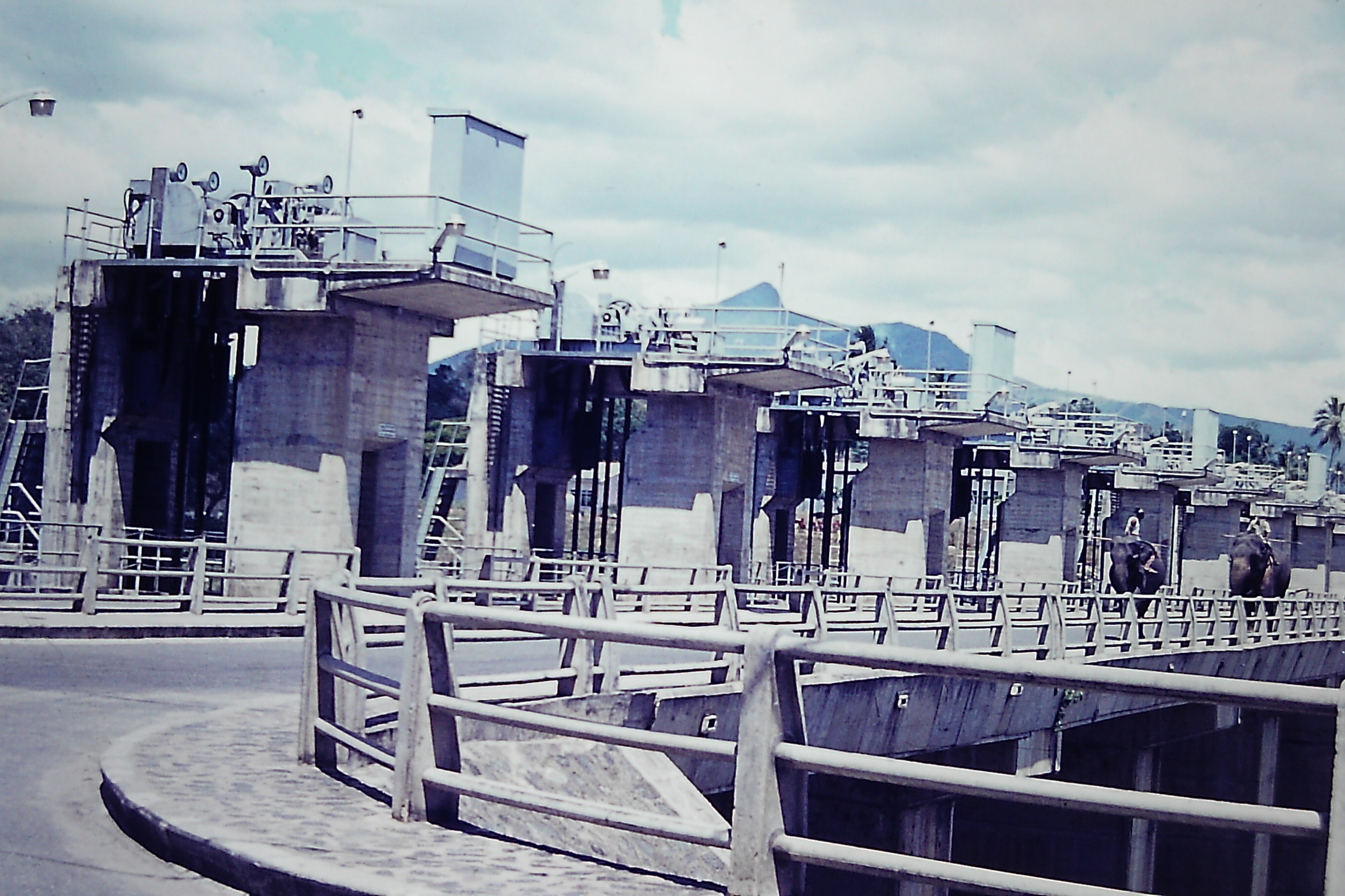
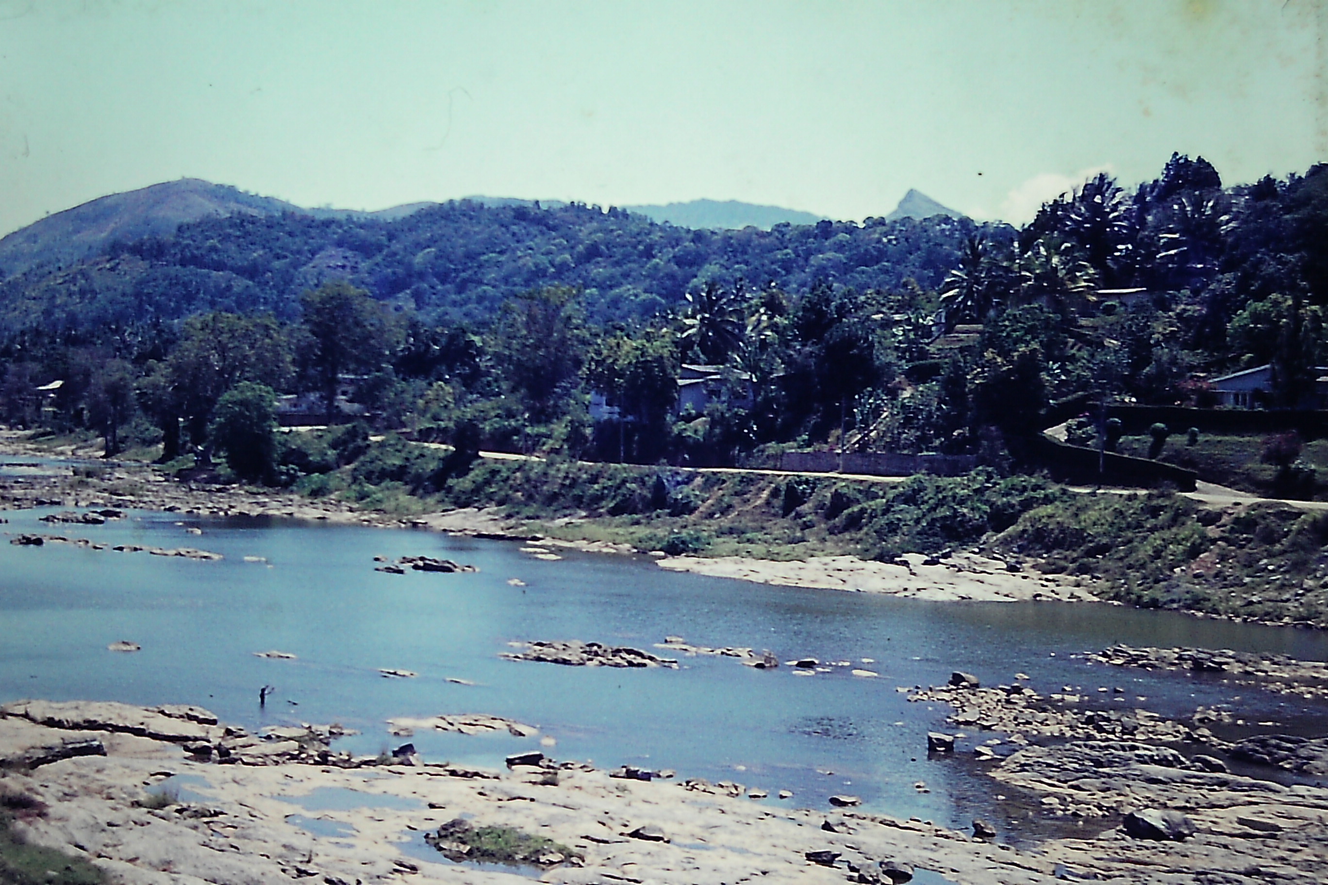
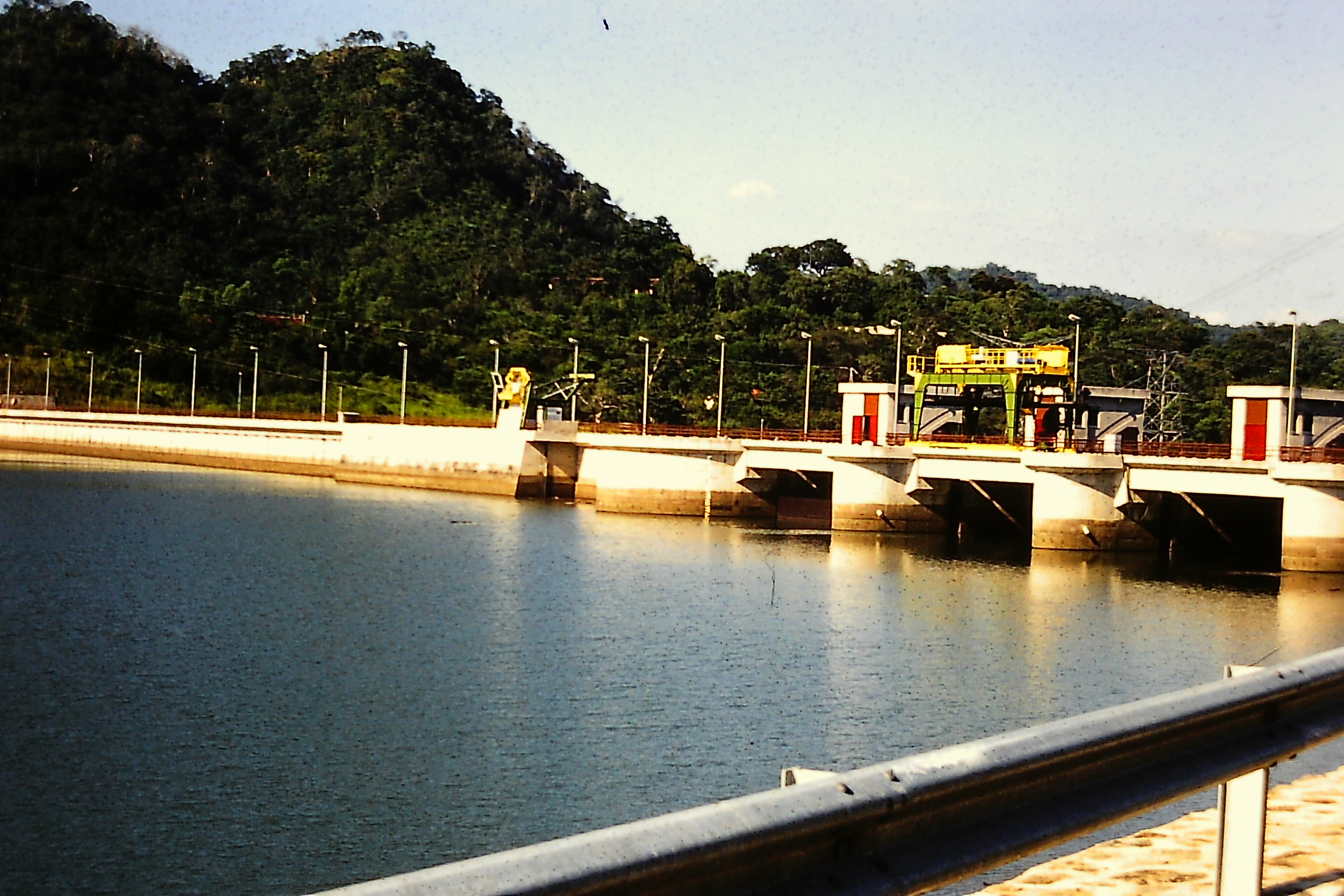
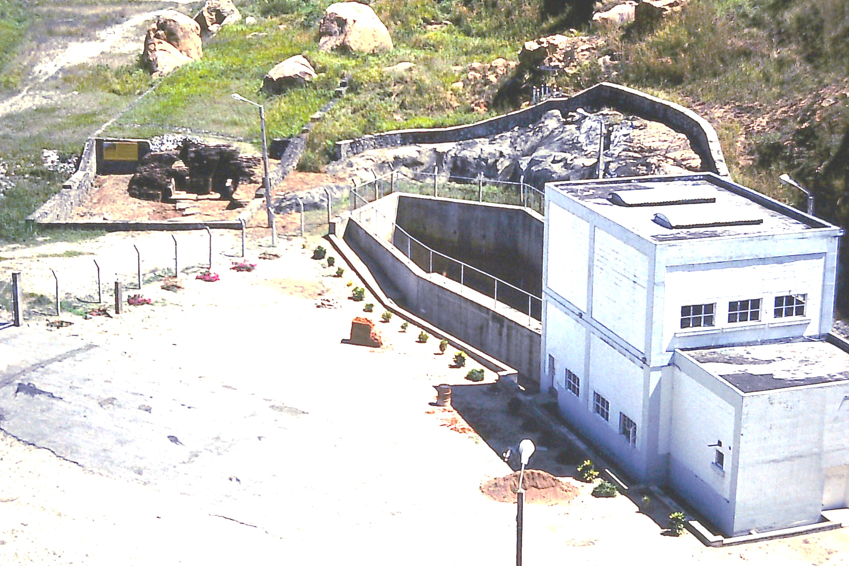
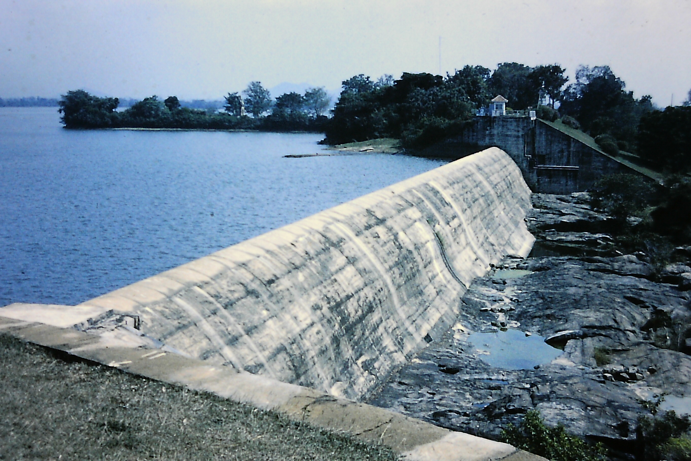
Fig 4. Polgolla Barrage - Mahaweli Ganga (River)
Fig 5. Victoria Arch Dam and Catchment Environment
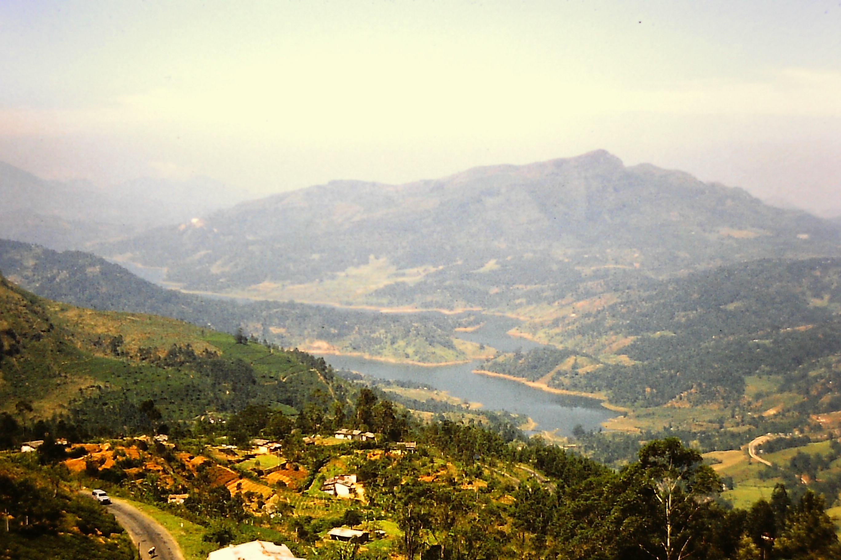
Fig 6. Randenigala Rockfill Dam, Mahaweli Project
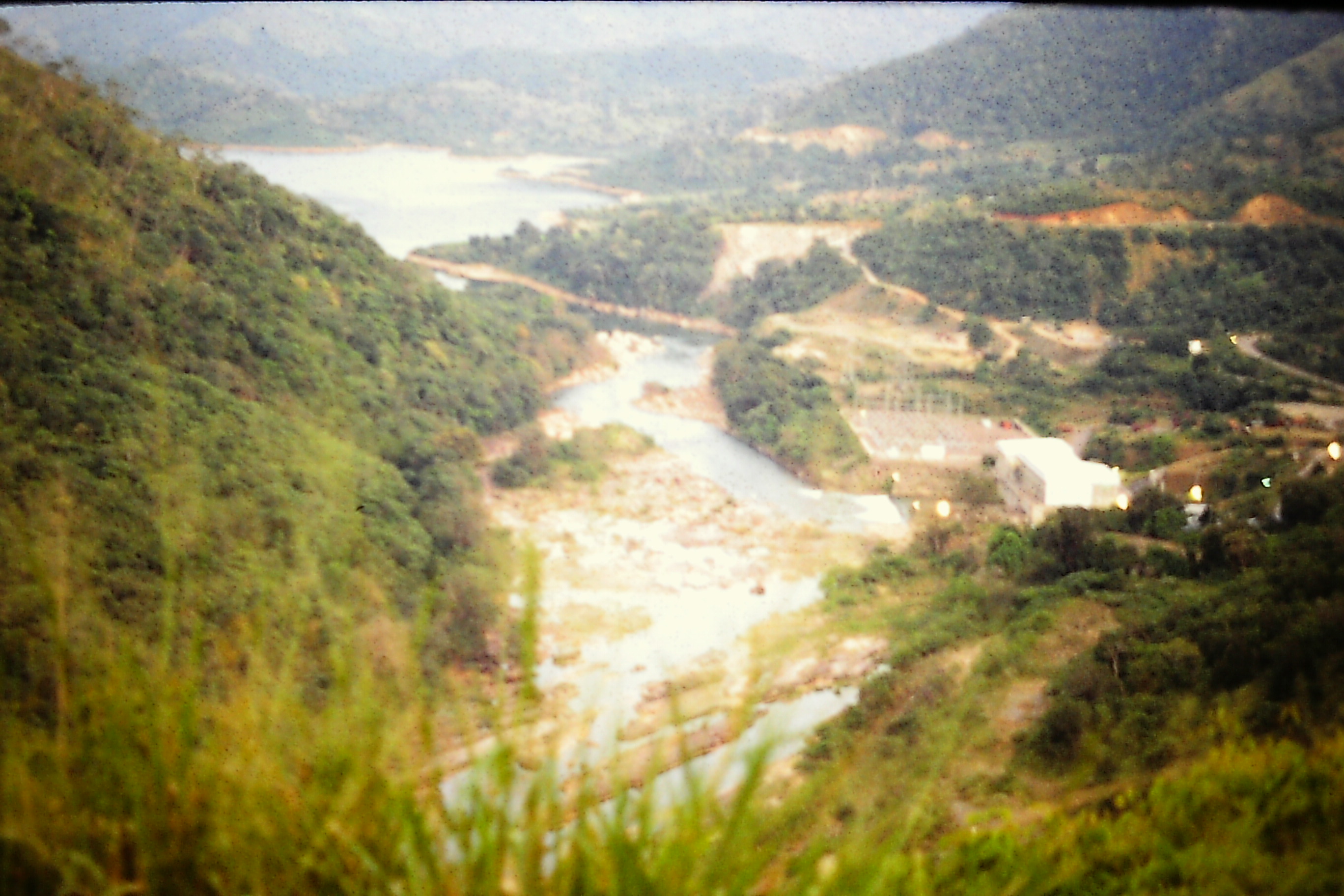
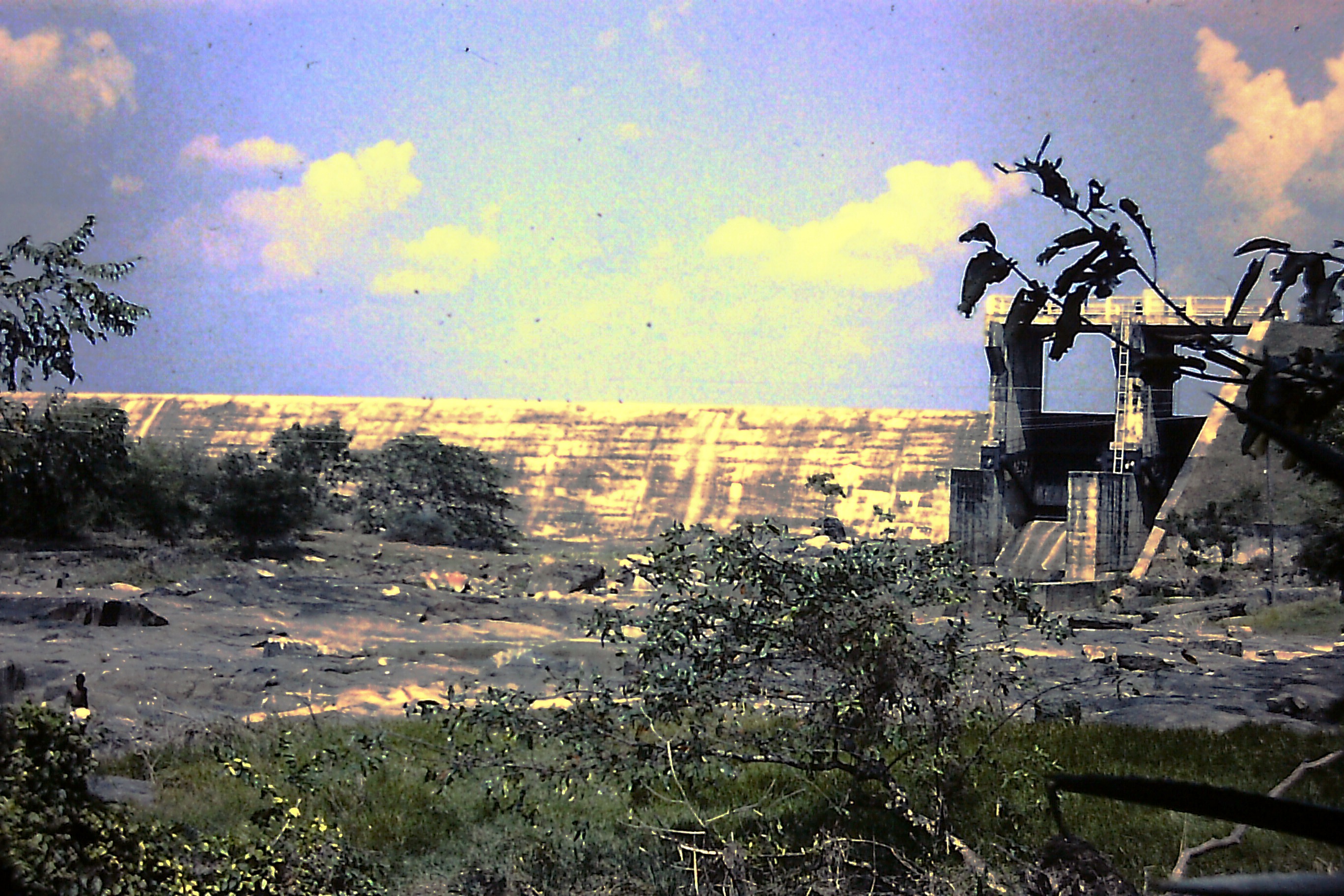
Fig 7. Rantambe Dam, and Minipe Diversion Weir
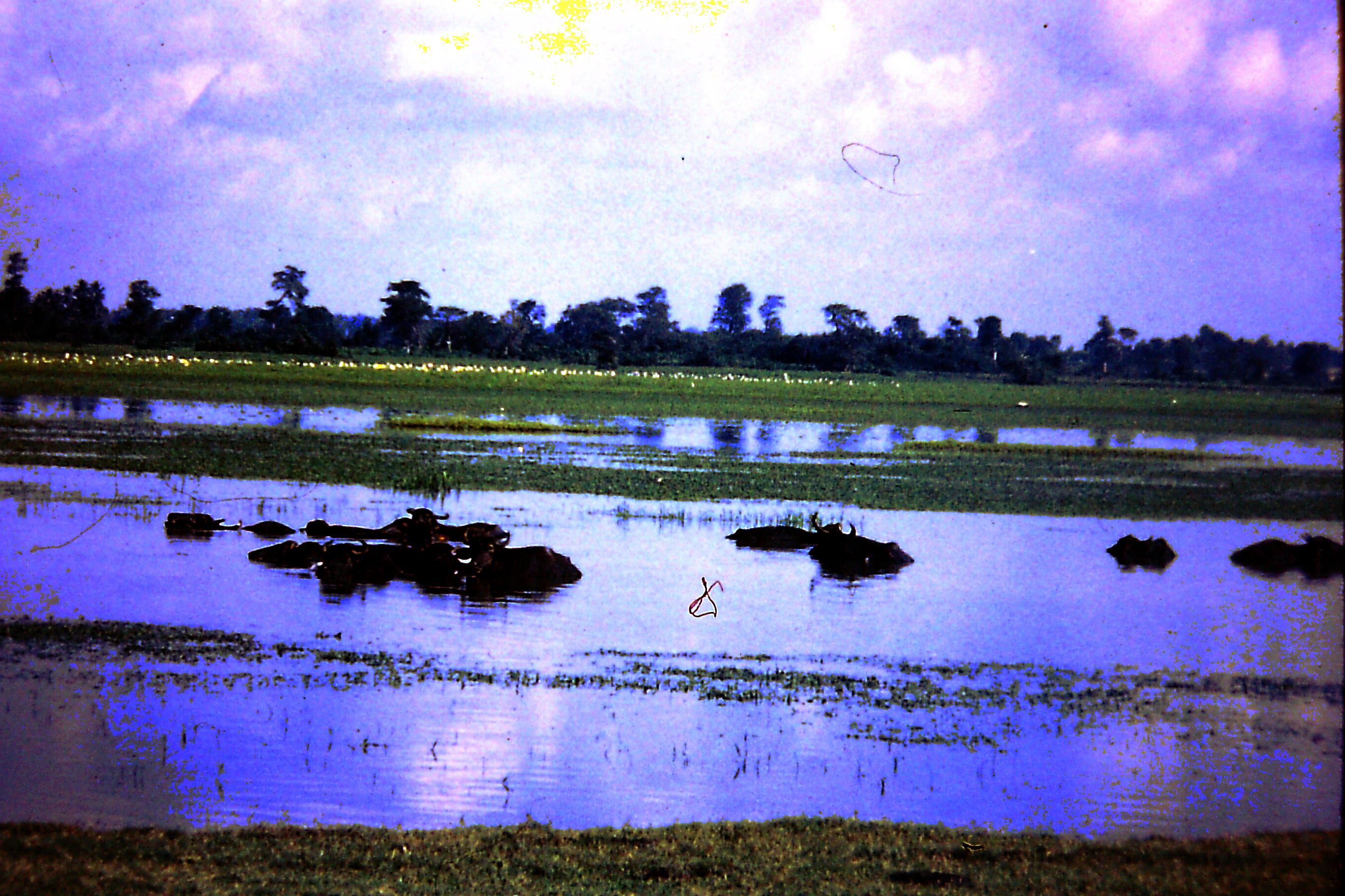
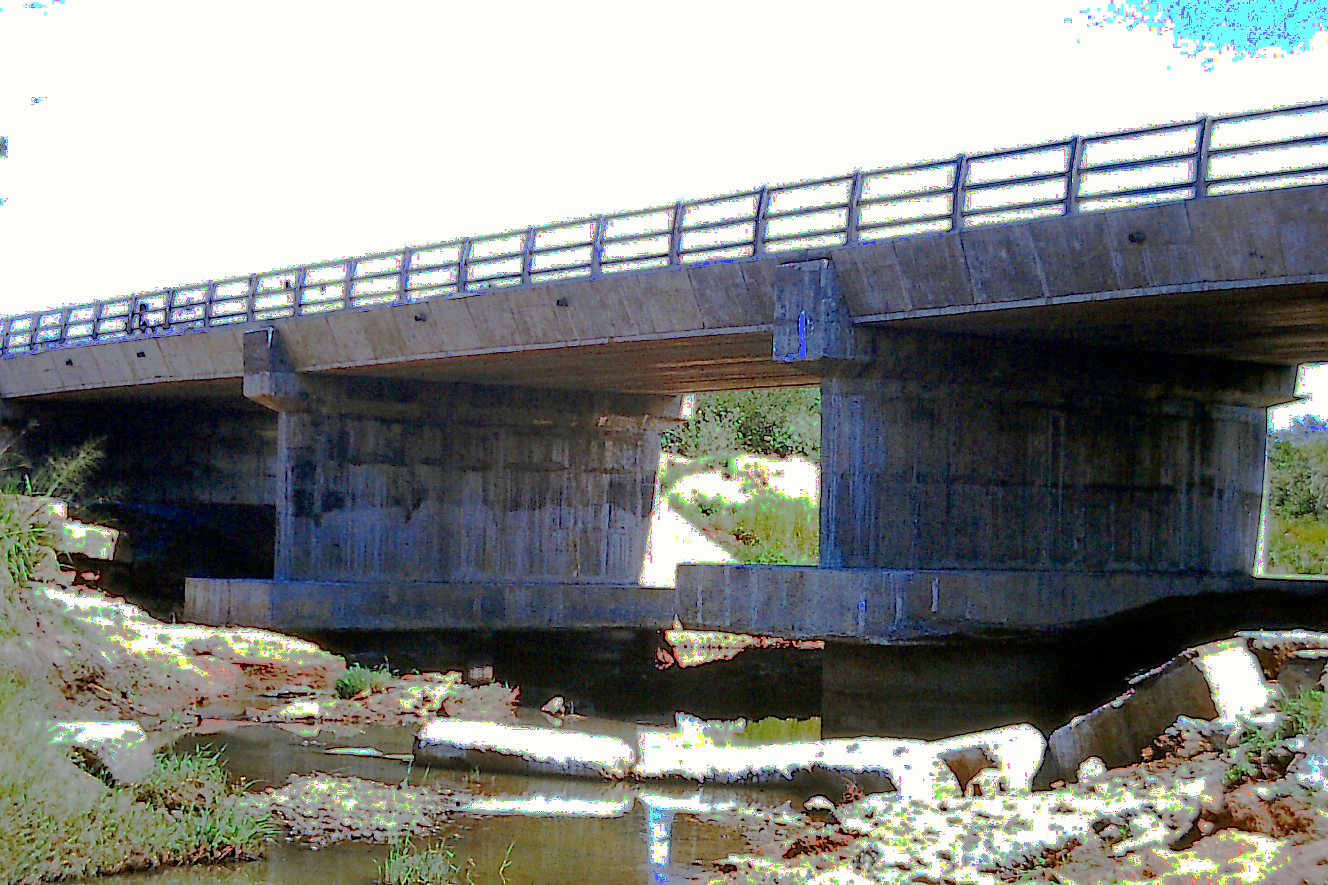
Dam, Mini Hydro Power Station, Ancient Sluice, Concrete Lined Canal, Villu - Mahaweli Riverine Wetlands, Bridge Scouring.
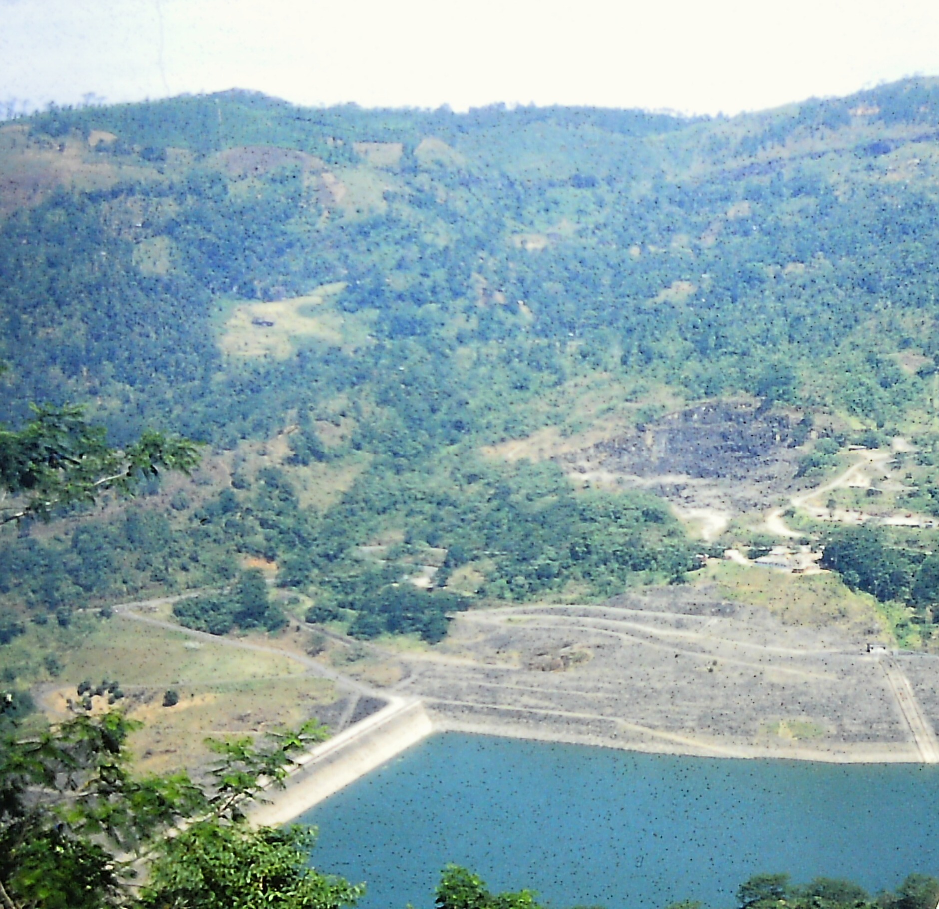
Fig 8. Maduru Oya Rock-fill Dam - Environment
DOWNSTREAM SETTLEMENTS
The downstream human settlements in the dry zone under the Mahaweli irrigation schemes are demarcated into zones which are called Systems [1,4]. These Systems occupy large areas of the Eastern, and North Central provinces as shown in the (Fig 9).
Over 256,000ha, almost two thirds of the total proposed land area of Mahaweli Project lands, were covered with forest. Chena (slash and burn) cultivation extended over 39,660ha or 10 percent of the total land area under the project. About 6,070ha of privately owned paddy lands and highlands in the ‘System H’ were acquired under the Mahaweli Project for resettlement [1].
The System H lying in the Kalawewa catchment in the North Central Province has a total area of 30,769ha, and is augmented or fed by the waters transferred at Polgolla Barrage. The irrigation infrastructure developments in the System H area included improvements to the Kalawewa and Kandalama reservoirs, construction of new reservoirs, the improvement of existing village reservoirs, and construction of a thousand and one distributary canals [1].
The System C in the Eastern Province, being an underdeveloped area with 23,886ha in extent, required more miles of roads, besides about 1,000 miles of irrigation canals, roads and a vast array of social infrastructure buildings common to all Systems. The conditions in System B with 47,773ha under Maduru Oya Project are similar to that of System C.
Apart from the increased rice production, alternative subsidiary crop production during Yala (South West monsoon, May – July) season is a successful programme in the Mahaweli Development Project [1,4].
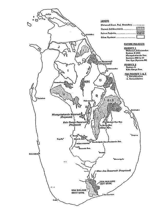
Fig 9. Map of Mahaweli Project Irrigation Settlements
IRRIGATION
Before the coming of the Mahaweli inter-basin transfer augmentation, most irrigation schemes had the characteristic of isolation. Since the first century AD there has been augmentation of few major reservoirs from the diversion works (anicuts - weirs) of Amban Ganga (tributary of Mahaweli River) and the Mahaweli Ganga1. The majority of diversions feeding the reservoirs in the dry zone have received their yield from the North East monsoon or Maha season from December to February, with an average annual rainfall about 1650mm. In most schemes this North East monsoon yield is inadequate for the irrigation of two successful cultivation seasons a year. The unique advantage of Mahaweli Ganga diversion inter-basin transfer is that the Mahaweli upper catchment receives its run-off from the rainfall in both monsoons in the island, and in most months of the year, with an annual rainfall of 4,000mm to 5,000mm [1,10]. The increased reliability of irrigation water for both cultivation seasons Maha (December – February, April) and Yala (May – September) of the year attributed to Mahaweli Development has made a significant benevolent impact compared with isolated local irrigation schemes that do not benefit from the Mahaweli waters.
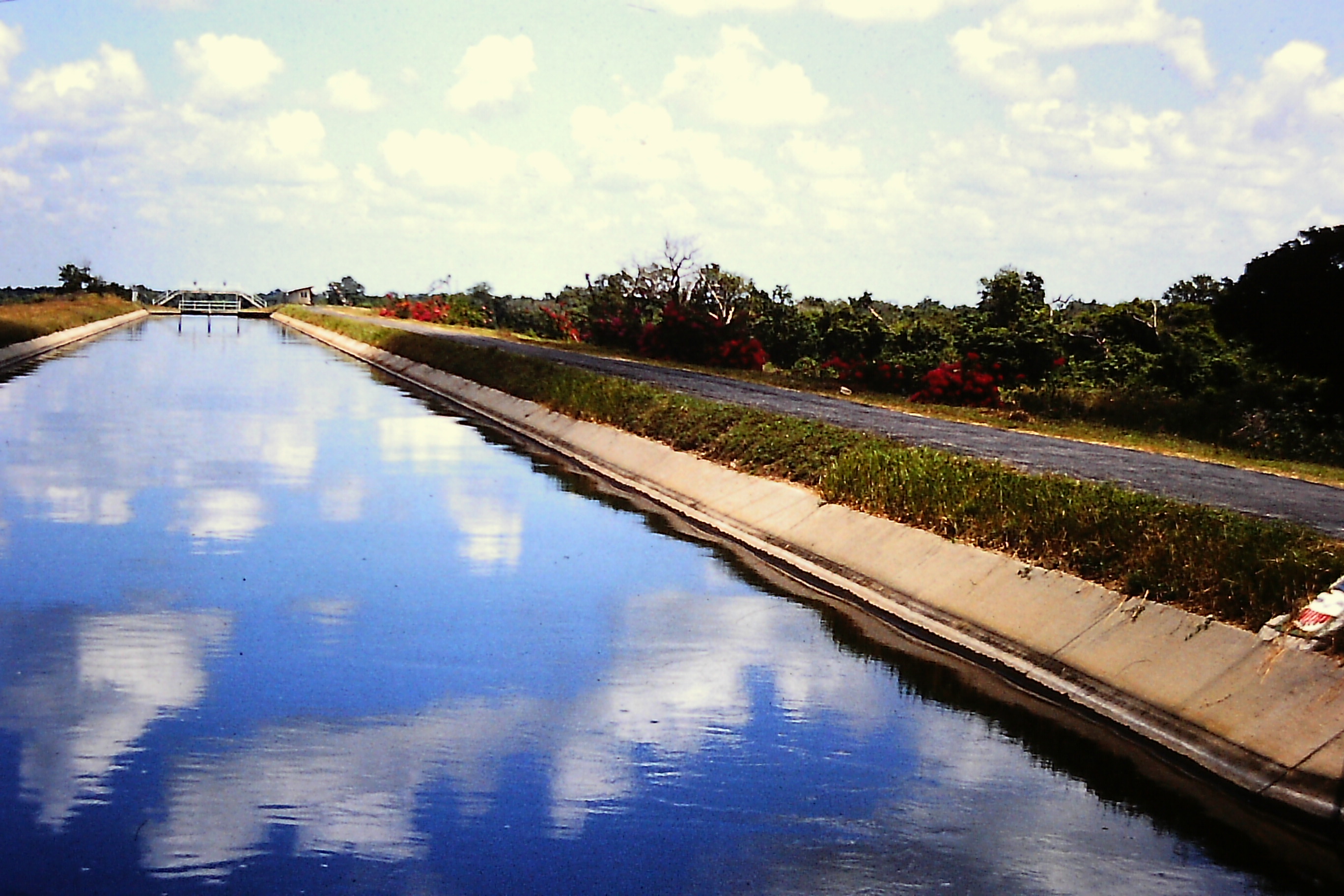
The seepage losses are an important factor in irrigation schemes [1,16,19]. Therefore few major canals constructed across well drained soils in the Eastern Province, such as Maduru Oya main and branch canals are concrete lined [1].
Few cases of salinity have been reported in the System H irrigation area. From soil and irrigation water tests carried out, one report has deduced that water is of tolerable quality for irrigation with provision for leaching [21]. Another survey promulgates significant increase of total salt concentration, sodium (SAR) and residual carbonates (RSC) in irrigation waters in the Kalawewa area of the System H, in April (end of Maha season harvesting period), and to a certain extent in November (end of late Yala season harvesting period) [22]. Some well waters sampled in the System C area in the Eastern Province have been found unsuitable for irrigation, because of high salinity indicators [12].
PUBLIC HEALTH
Malaria has been an endemic tropical disease in Sri Lanka from time immemorial. Nevertheless, with modern preventative and curative campaigns, malaria was virtually eradicated from the island in the early sixties. Stagnated pools of water are favourable sites for breeding the malaria vector Anopheles mosquito [23]. However, since the late seventies when the Mahaweli settlements commenced, malaria has been an endemic disease in the North Central Province, and is regarded as a threat to community health in many regions of Sri Lanka [13,23,24,25]. Vigorous preventative – prophylactic, and curative campaigns have been relaunched since the beginning of settlement in the Mahaweli Project areas [26]. Schistosomiasis (bilharzia) a most commonly associated disease with large irrigation projects in the tropics, is not found in Sri Lanka [13,27]. Water-borne gastroenteritis and other diarrhoeal infections are common in the Mahaweli Project areas, but not acute [26,28]. There has been an outbreak of cholera in 1974 in the Mahaweli settlement area that lasted until 1976 [13]. Mortality of infants and children from diarrhoea is almost absent [28]. Japanese encephalitis (dengue) is reported a major health problem in Sri Lanka; though the main vector breeds in rice fields, outbreaks have been reported in parts of the country peripheral to the Mahaweli settlement areas [23]. All in all the health situation in the Mahaweli Development areas is not markedly different from the rest of the country, except for instance the danger of malaria.
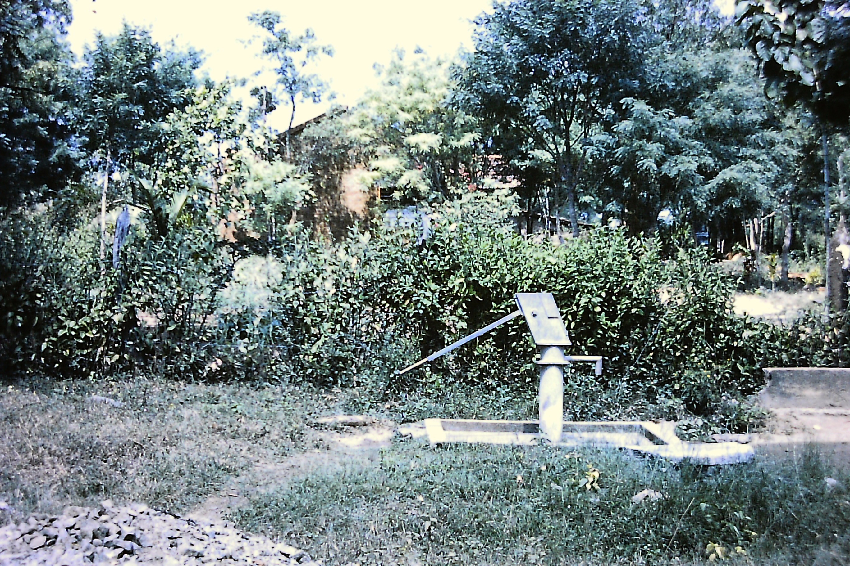
The main source of drinking water supply is shallow wells fitted with hand-pumps. A small percentage of households have their own wells. Except the wells near reservoirs many dry out during the dry season. Also after few years wells fall into decay with covers removed and hand-pumps broken and removed. The deep wells (borehole tube wells) produce a small yield and rarely dry out, and can serve about 50 families; the capital cost is high, about 5 times the cost of a shallow well, but more economic and beneficial. Drinking water supply from shallow wells in the region is inadequate and the settlers travel long distances in the dry season to wells with water, main canals, and reservoirs to fetch water [13,28]. To improve the conditions deep wells are being constructed in favourable locations [28]. Standpipe water supplies are available in many townships in the Mahaweli Development [29]. The construction and use of lavatories are very poor. Less than 40 percent of households have lavatories. Out of latrines built, about 35 percent are water sealed type and the others are pit latrines [28].
SOCIAL IMPACTS
The important social impacts can be identified in the two aspects of displacement from the reservoir construction areas, and resettlement in the new irrigation systems. The acquisition of private lands in the settlement areas also has had a similar impact.
A large number of families were evacuated from the Victoria and Kotmale reservoir sites. A majority of these people were resettled in the downstream settlements and the others have opted to resettle in the provisions made in the Kandy District, and Kotmale respectively [2,8]. Also the private lands and chena (slash and burn) cultivations coming under the new development areas were acquired and their owners were resettled [1]. As the Victoria reservoir inundated old shanty-towns, new towns were built to replace what were lost8. Fisheries are inspired in all large reservoirs. The availability of fish and the demand have encouraged people to take up fishing as a new livelihood [8,29].
New settlers in the downstream developments begin with both physiological and psychological stress. Except the small proportion of settlers who come from the dry zone, others come from a milder climate than the harsh dry climate in the downstream settlements. Physical tiredness, and sickness associated with the change in climate and poor drinking water supplies can easily hinder the progress of settlers’ initial work. Inter alia, the fear of wild animals, danger of snakes, and personal conflicts among the new arrivals causing a general feeling of insecurity are psychological components of the settlers [8].
A well formulated socio-economic welfare system is provided for the benefit of the women and children. The Mahaweli irrigation settlement Systems are managed by a team including vocational advisors of several disciplines.
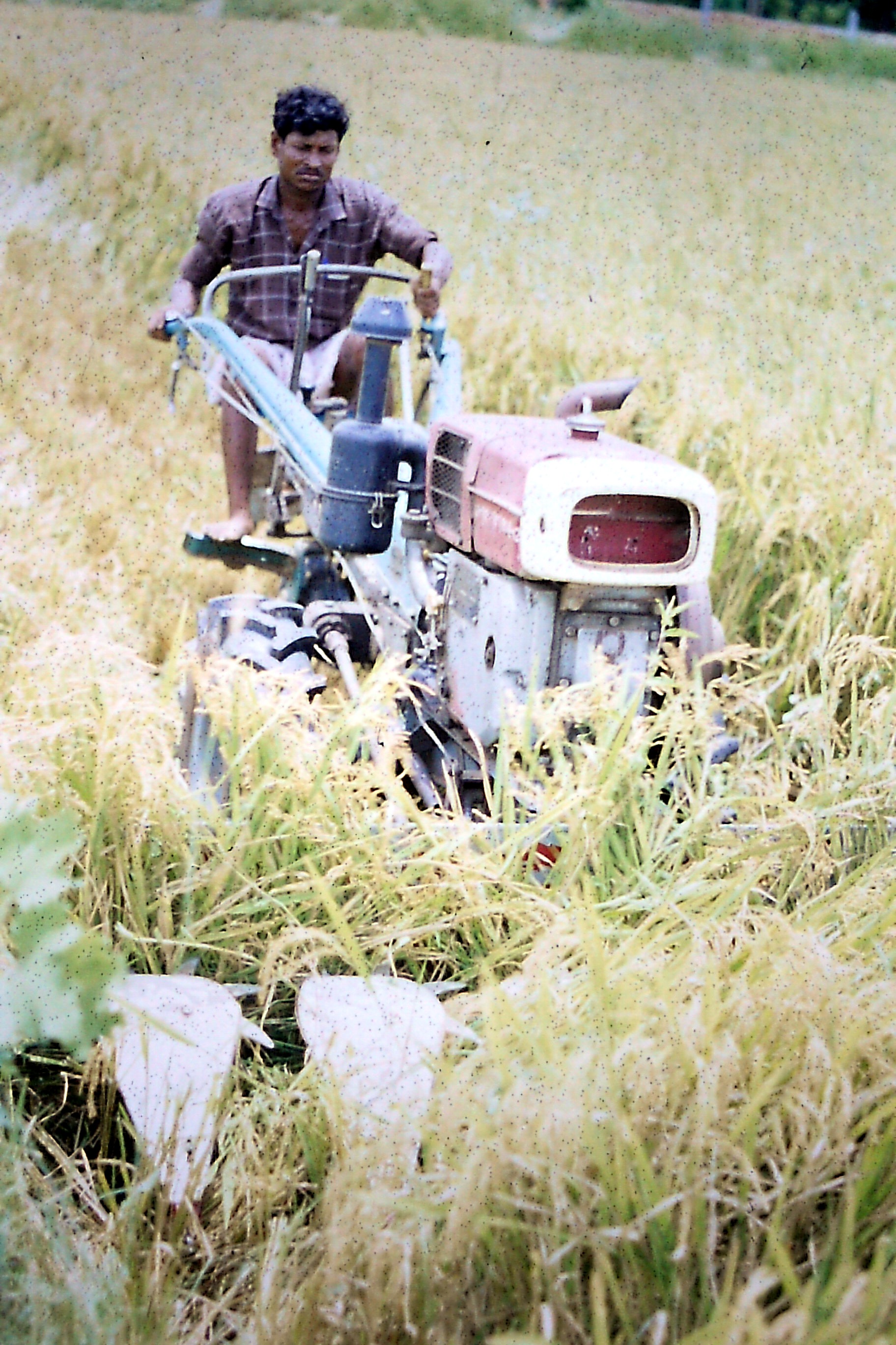
Training programmes for the training of junior managers, and for community participation have been successful and popular [28]. Farmers in Sri Lanka are in general adapted to semi-mechanical and scientific cultivation practices. The overall mechanisation of rice cultivation is still in its infancy, but developing.
A remarkable impact outside the Mahaweli development area itself is the extensive rural electrification with the benefit of Mahaweli hydropower projects.
Harvester Demonstration, Kalawewa Reservoir, Water supply Tank, Tube Well with Hand Pump.
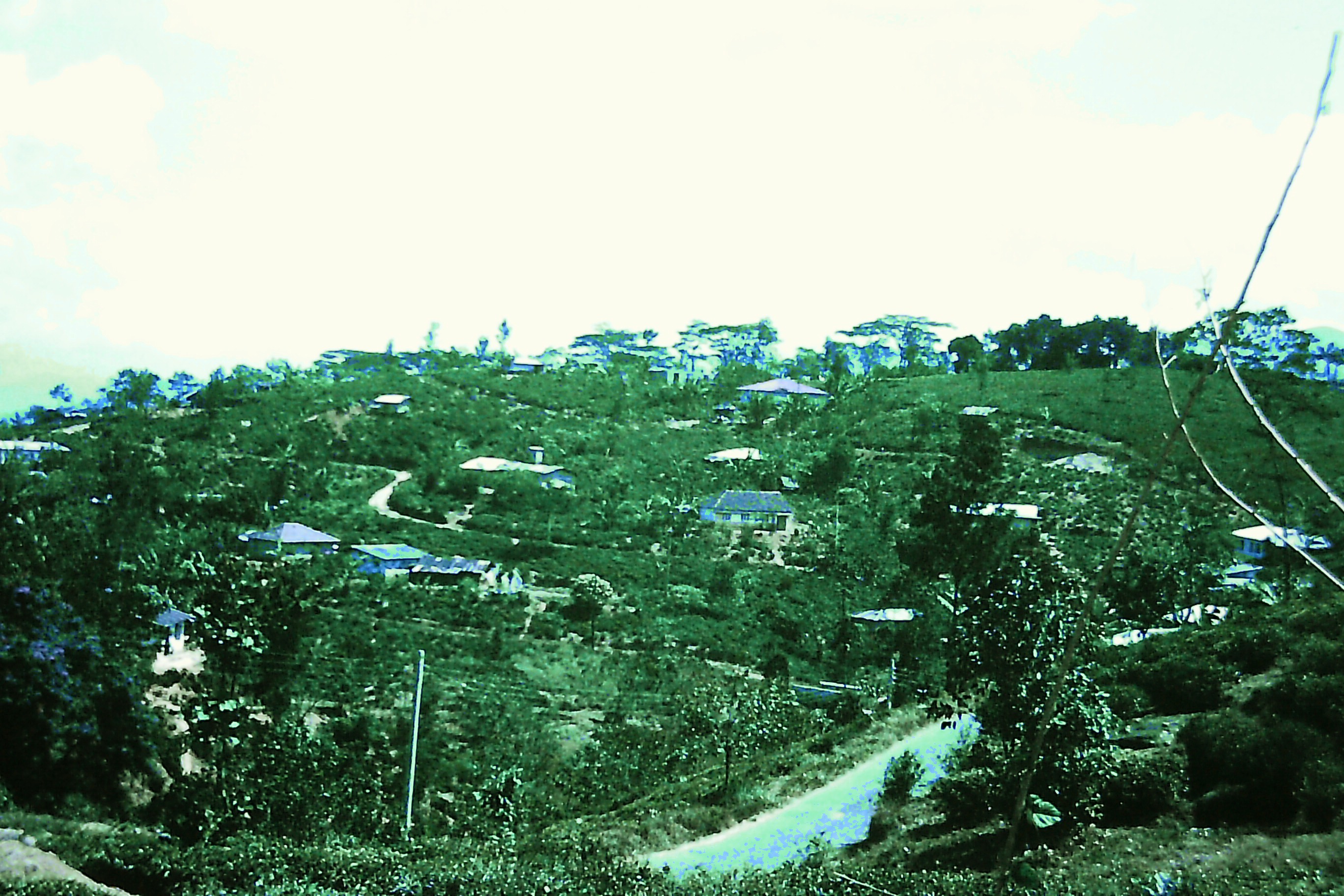
Fig 10. Settlement System H - Kala Oya Basin
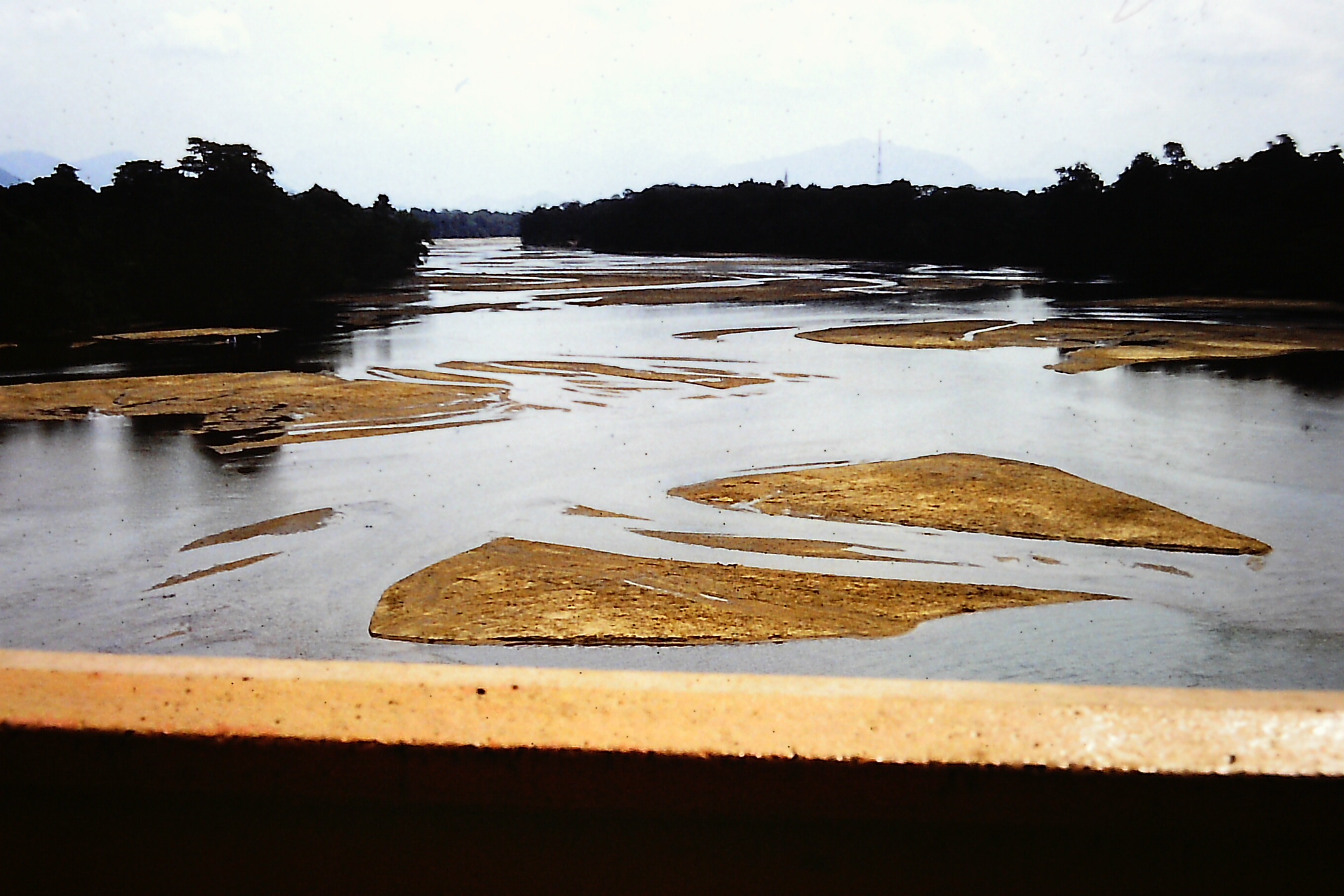
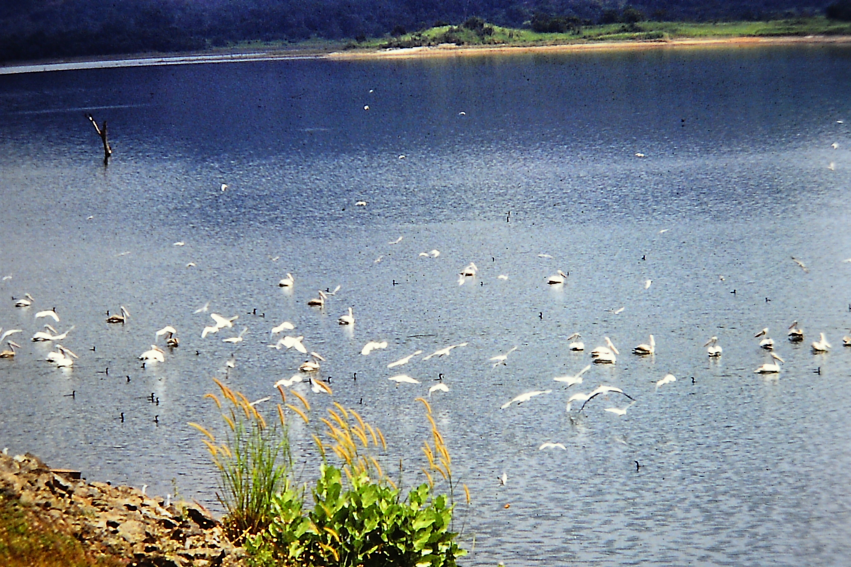
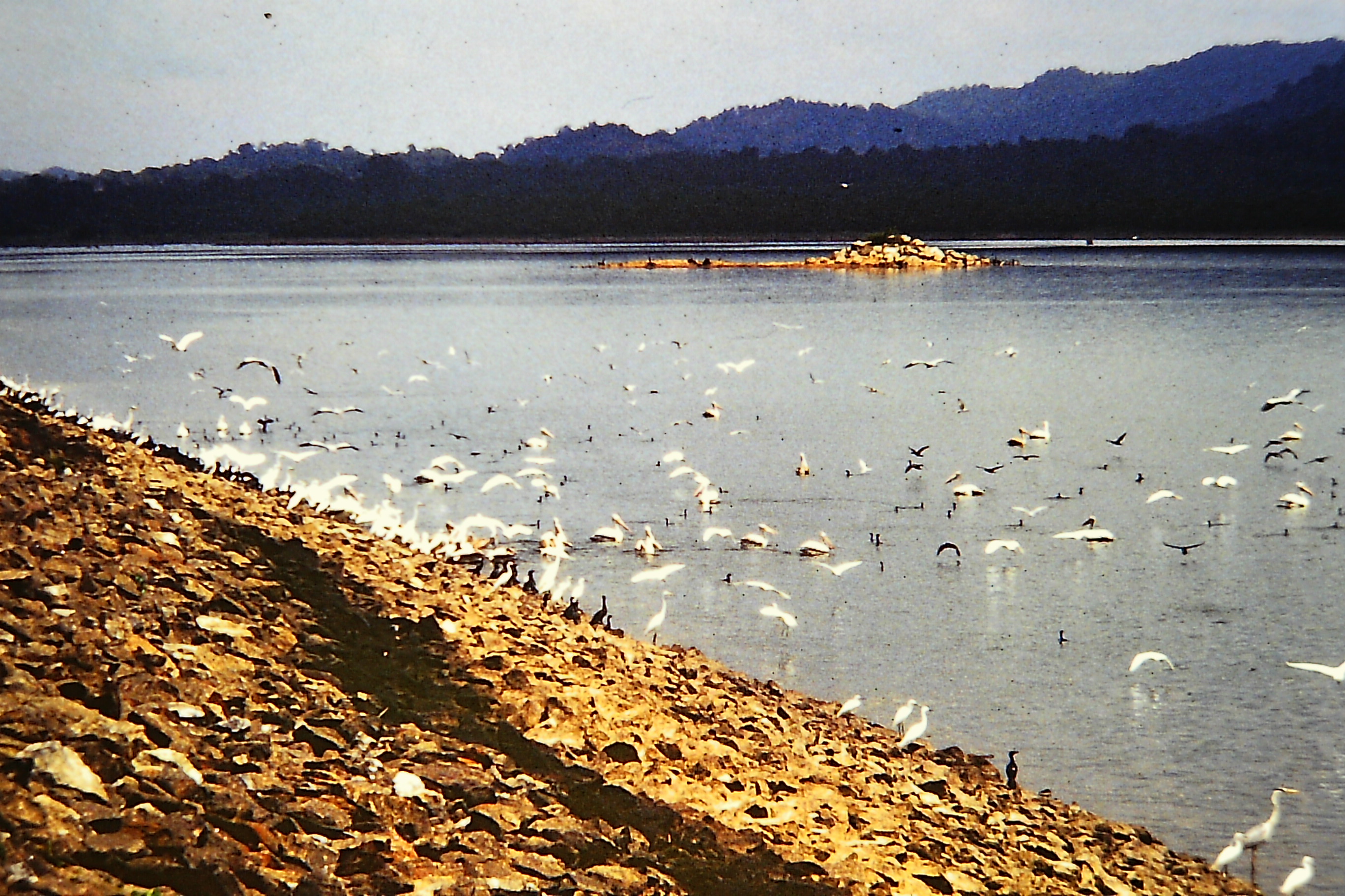
Mahaweli Ganga at Mahiyanganaya, Fortified Erosion Repair, Fisherman, Migratory Birds
Fig 11. Settlement System C, Ulhitiya Reservoir
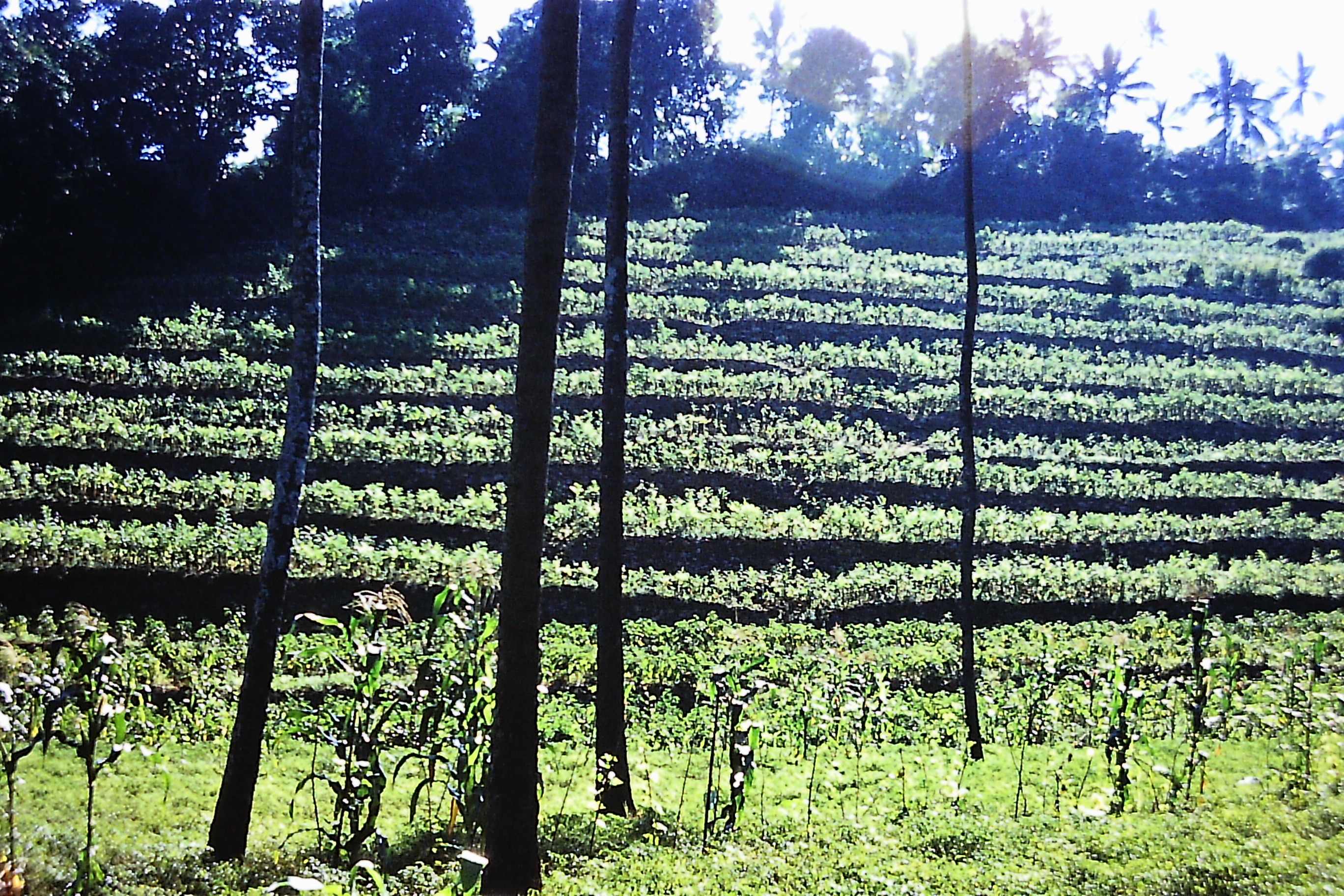
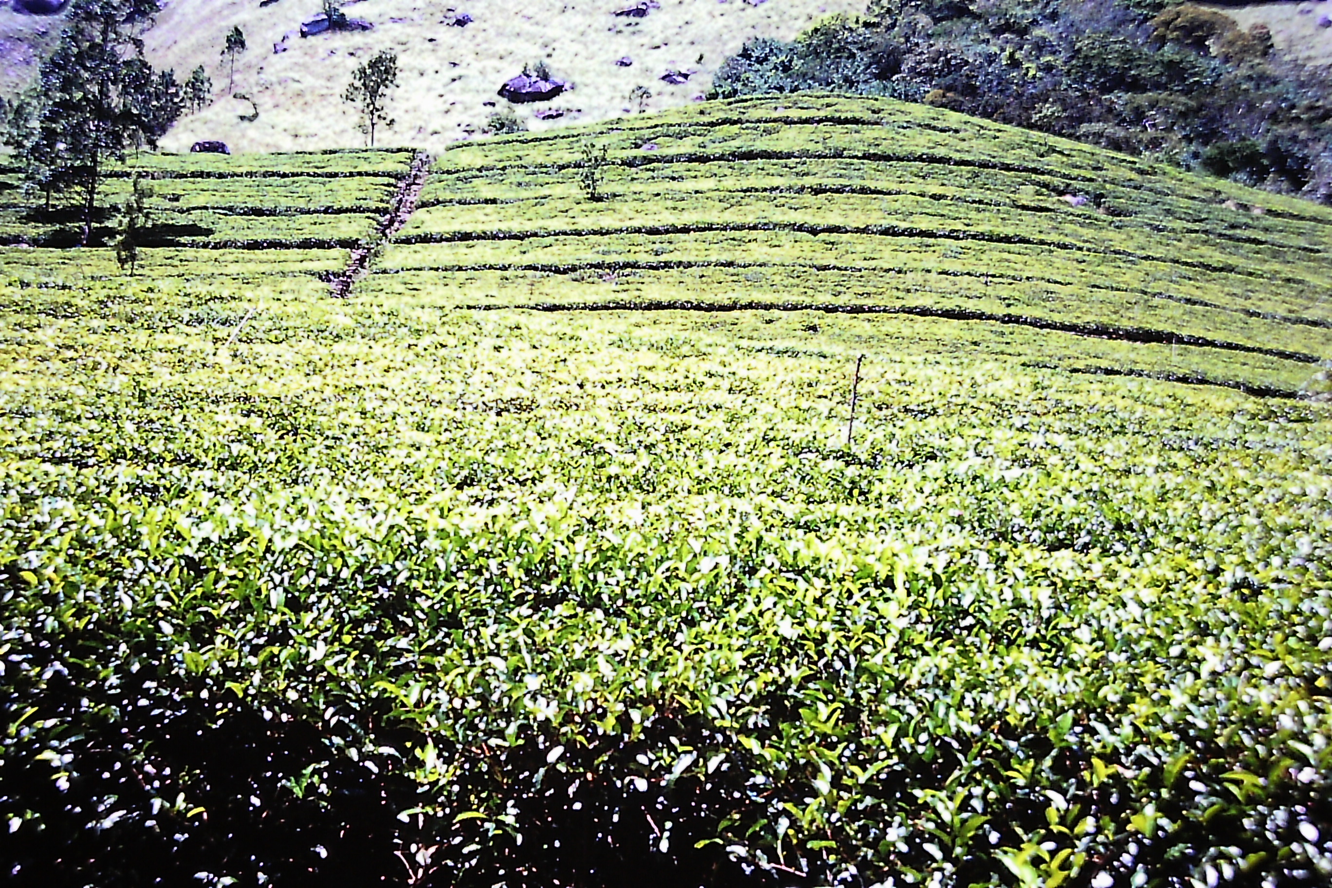
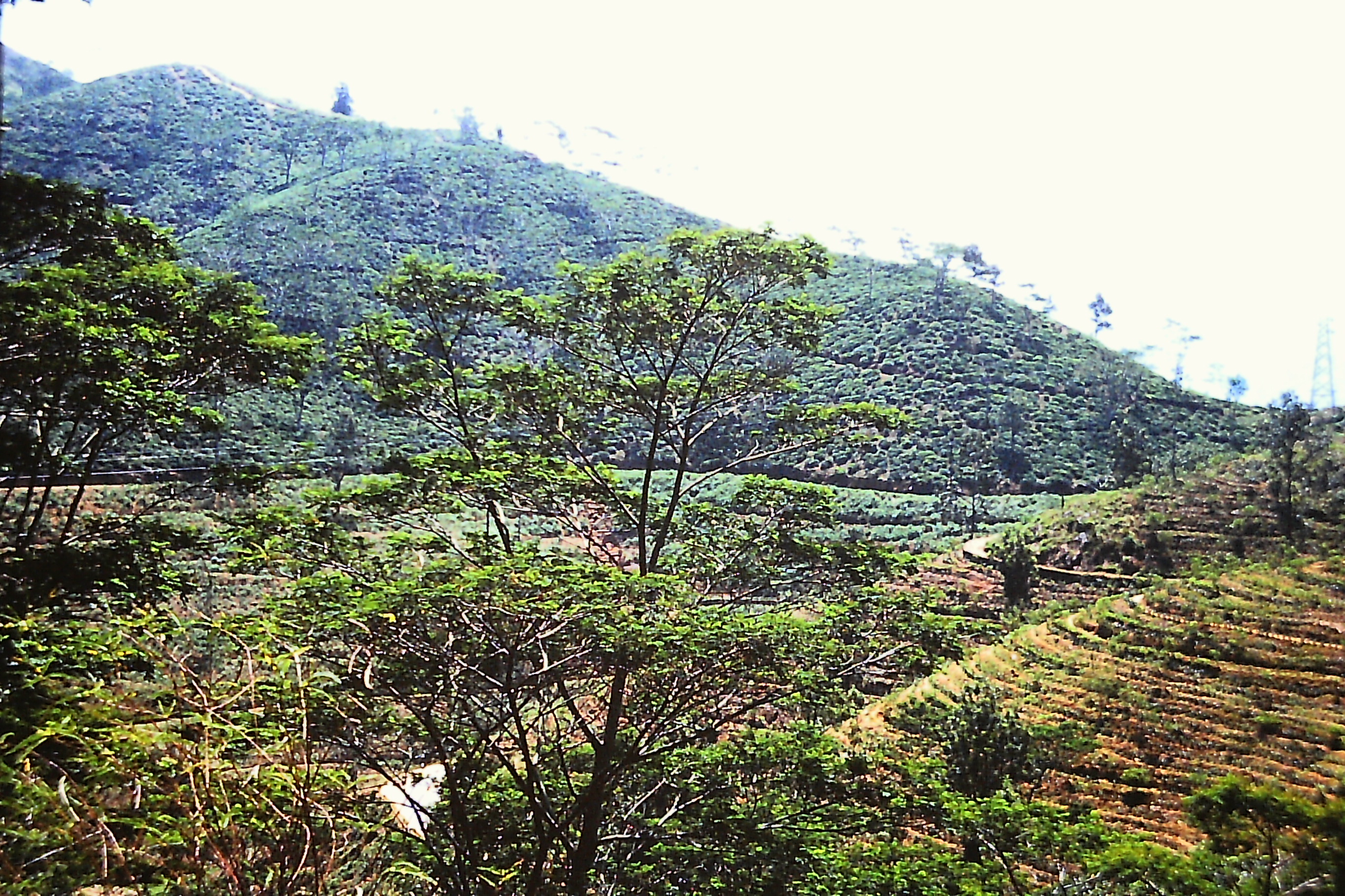
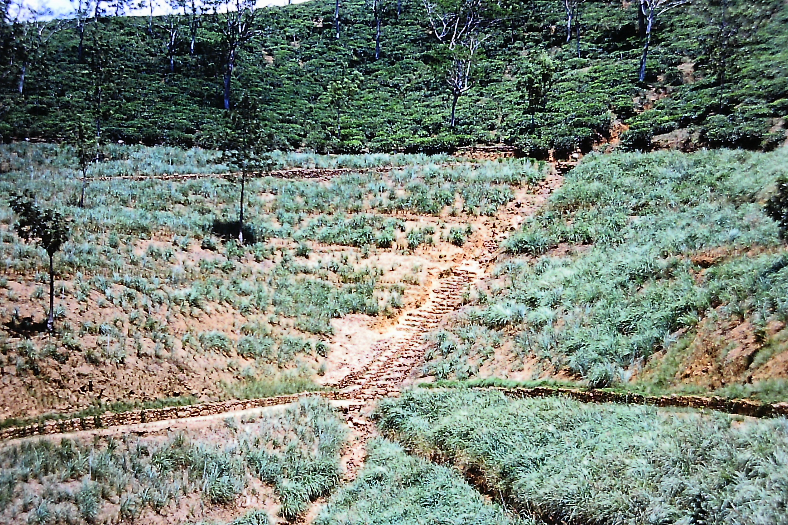
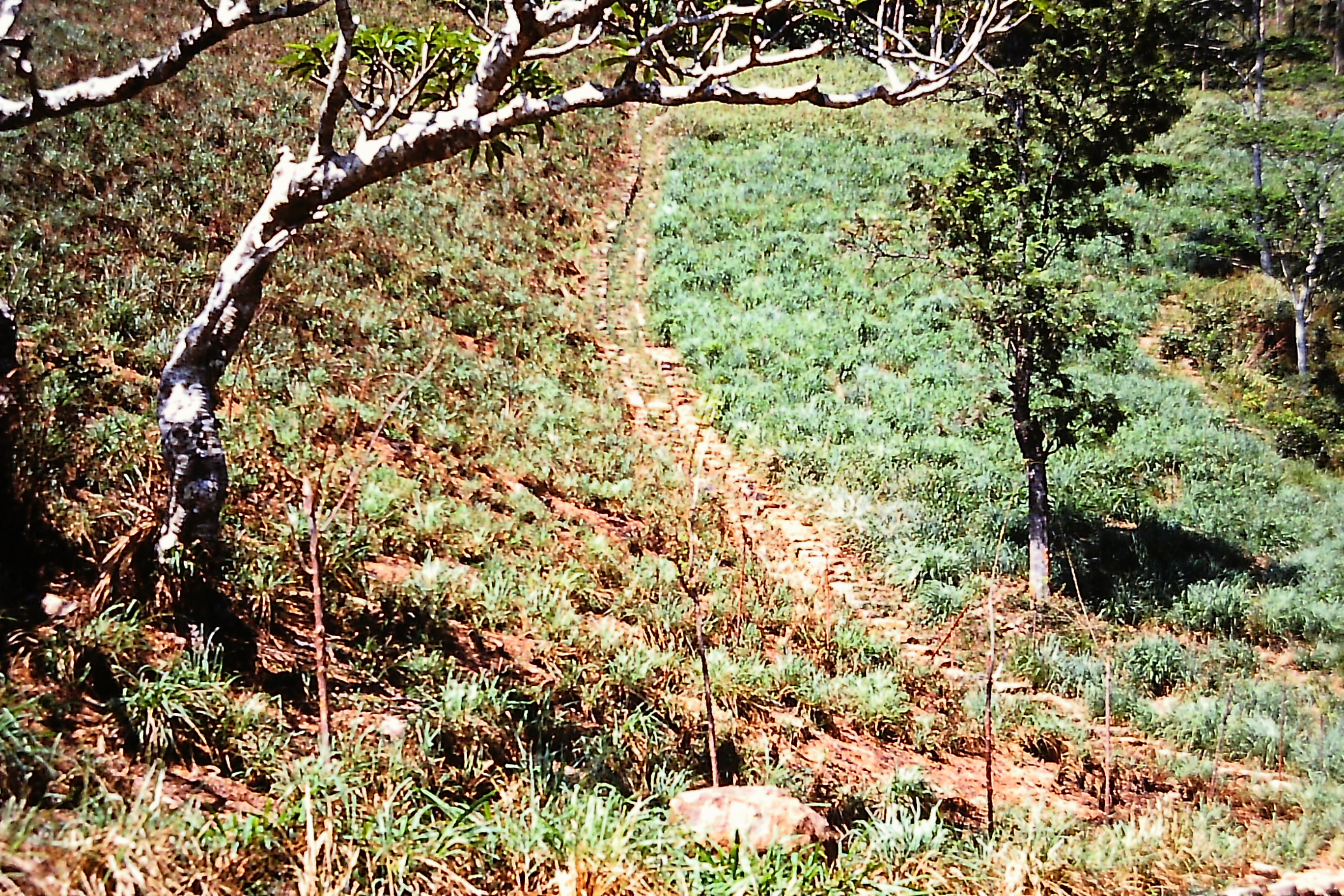
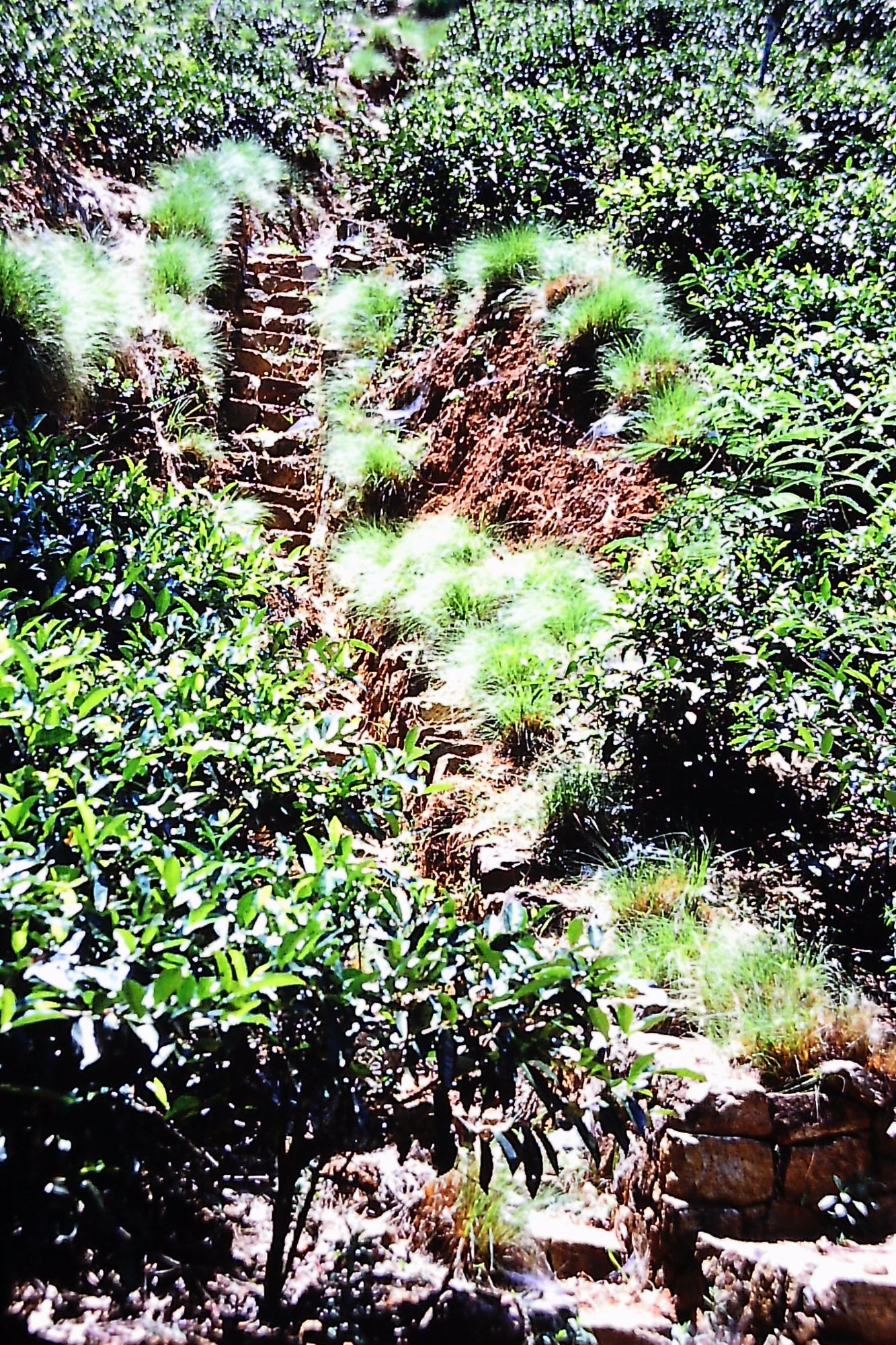
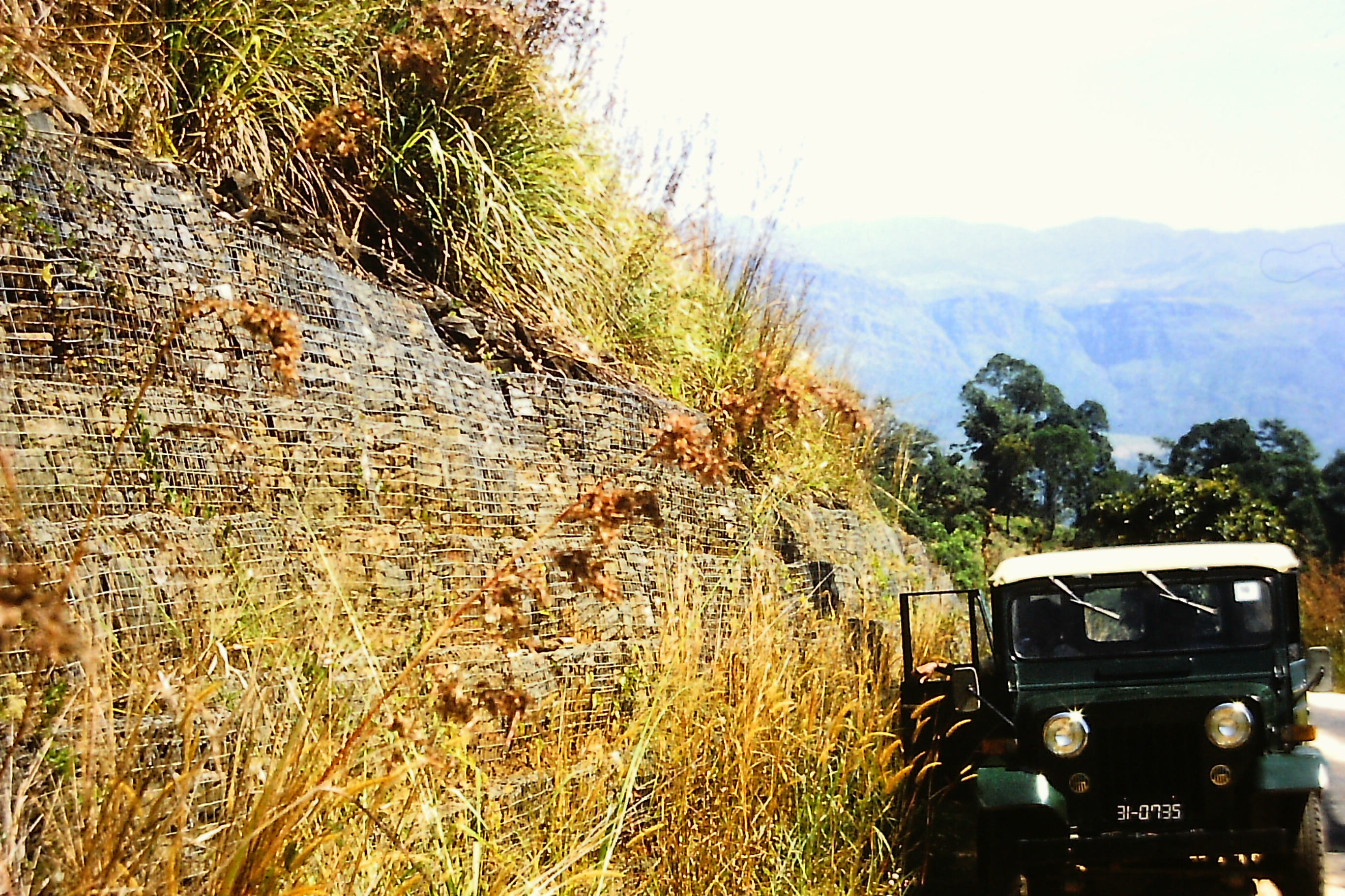
Soil conservation in Tea Plantations, and Kotmale Environment
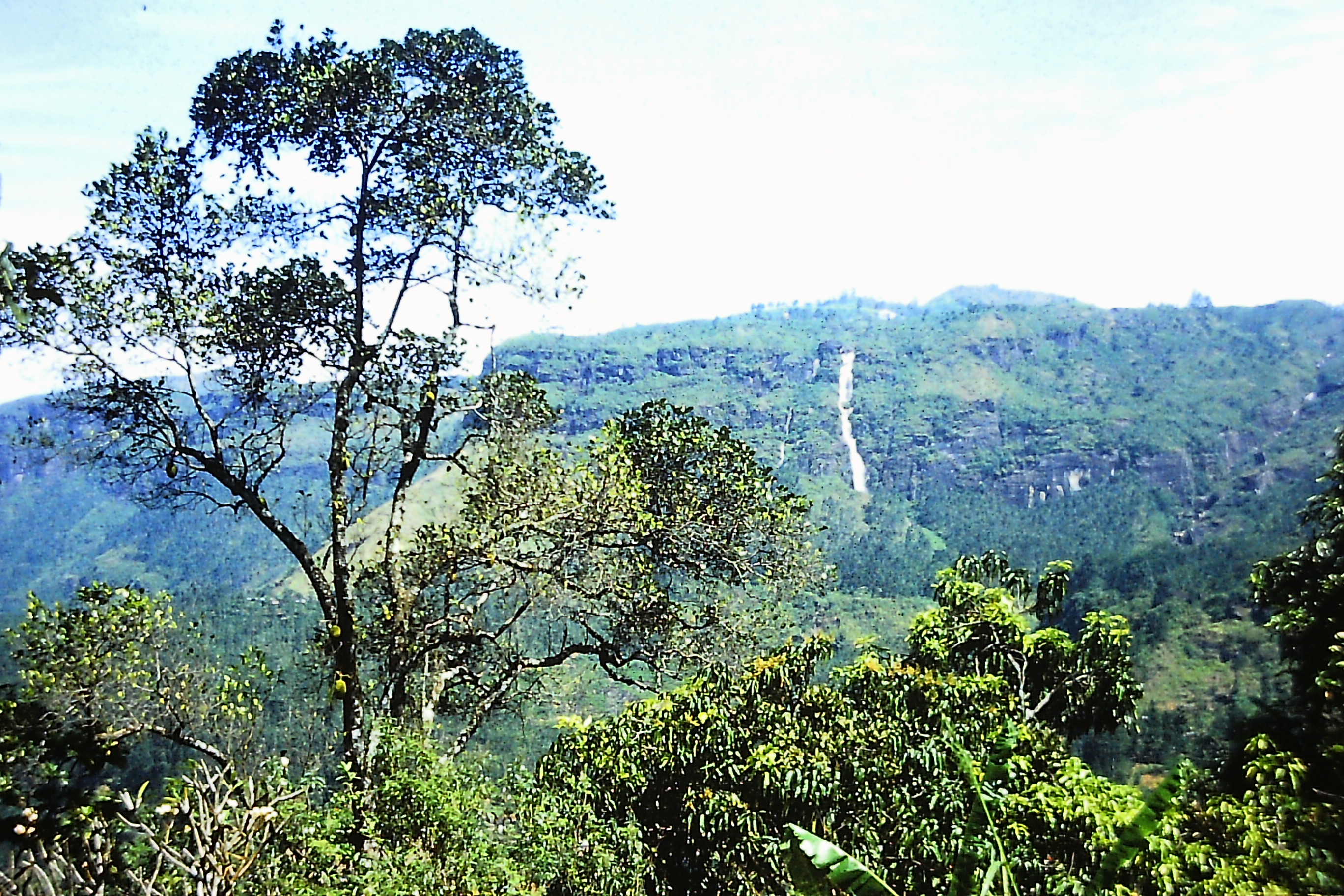
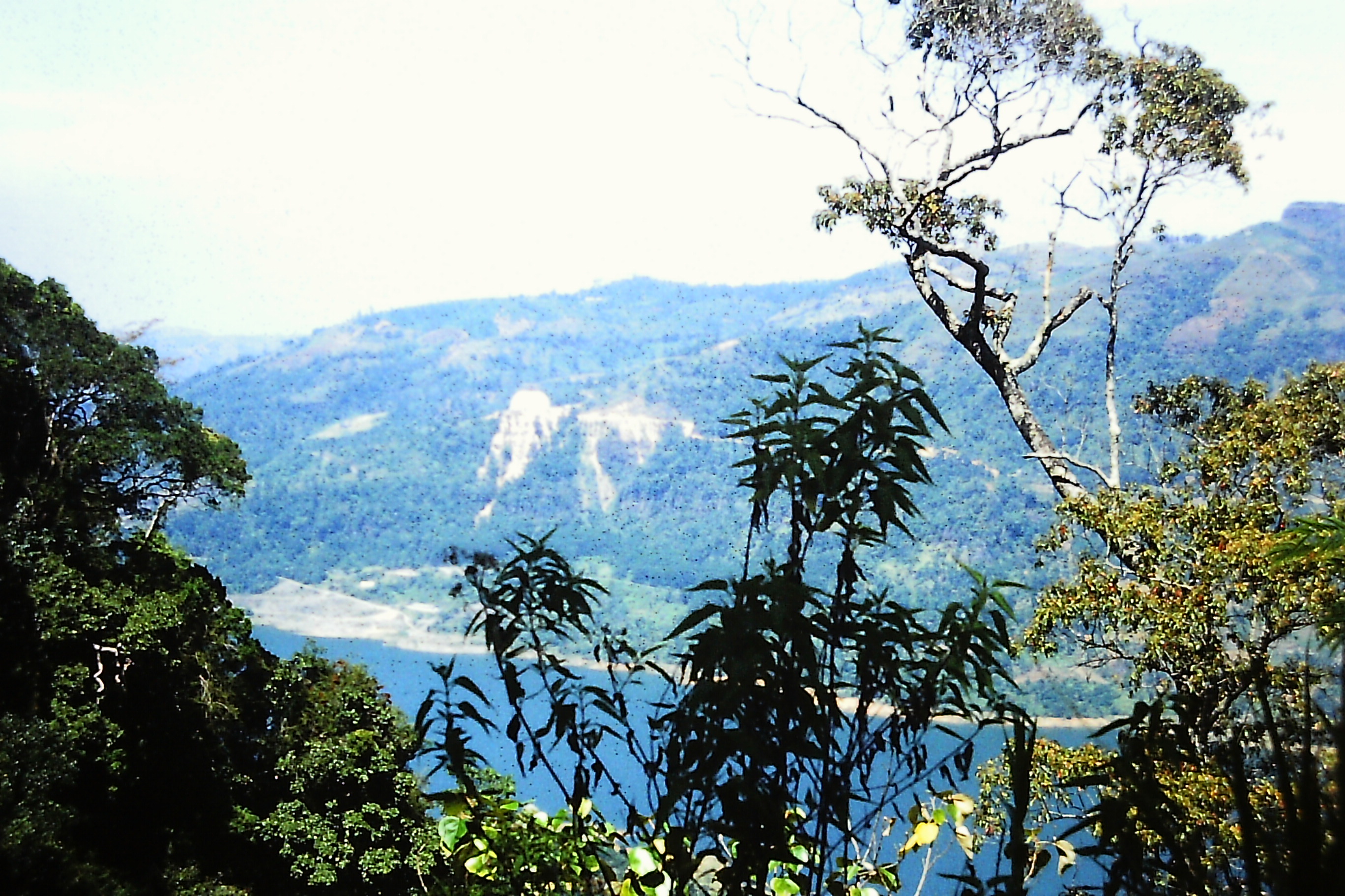
Fig 12. Mahaweli Upper Catchment
ENVIRONMENT
The Mahaweli Project areas can be considered in two separate regions as the upper catchment, and the downstream developments.
The extent of upper catchment which comprises the major reservoir catchments is more than 316,000 hectares [11]. In this area the intensively managed land comprised about 49 percent of which two thirds was mainly tea; 14 percent was covered in forest. The rest of the land consisted of dry land agriculture, chena cultivation, abandoned tea and grassland. The main annual temperature in the region varies little from 27 oC [10].
The previous practice of tobacco and chena cultivation has been banned from the immediate reservoir catchments as a means of reducing soil erosion, and they are encouraged to cultivate more permanent crops. Where tobacco is grown, cultivators are encouraged to implement soil conservation techniques. All estates in the catchment are required to provide sufficient ground cover in all ravines and gullies [29]. The Kotmale valley has a record of mass movements. There is no conclusive scientific evidence to show that Kotmale reservoir and its operations have caused the cracks and serious damage to houses in the area [27].
It is cited that soil erosion can be as high as 308 – 913 tonnes/ha/annum in badly managed tobacco lands [8]. Neglected tea plantations are also a source of heavy soil erosion [27]. On the other hand a well maintained tea cover provides best protection to soil [8]. With an estimated average annual sediment yield of 300 m3/sq kilometre, with allowance for bed load, the total sediment load is about 1mm3 per year. It is considered that this sedimentation rate would not impair the effective operating capacity of the reservoirs for more than 50 years [10].
The Water Resources Board has found that groundwater is heavily polluted by agrochemicals in some of the tube wells drilled in the area around Nuwara Eliya, making it unsuitable for human consumption [8]. The heavy use of fertiliser and agrochemicals in the tea estates and the vegetable plots poses a serious problem to the Mahaweli reservoirs. The fact that Mahaweli waters are conveyed a considerable distance through the inter-basin transfers, highlights the need for vigilance on monitoring water quality in the Mahaweli areas [8].
Flood peaks in the Mahaweli Ganga will be considerably reduced by the storage in the new reservoirs and controls in the headworks. The Kotmale dam is built below its maximum capacity due to cost escalation attributed to geological weaknesses discovered during the construction. Victoria reservoir is built for maximum capacity without flooding Polgolla. The new hydrology of Mahaweli Ganga particularly below the dam sites could increase stagnant pools favourable for breeding malaria spreading mosquitoes [23,24,27].
Swollen river conditions of Amban Ganga attributed to overloading by Mahaweli diversion operations have been sighted. The replenishment and spilling of many reservoirs in the dry zone augmented by the Mahaweli waters are now influenced more by the diversion operations than the mass curve hydrograph based on local catchment inflows. In the downstream areas the clearance of forest will increase the runoff factor; the paddy fields with water retaining bunds will control the runoff, and increase the base flow. In the same context the evapotranspiration will be reduced, but the evaporation will increase from the imported waters covering large surface areas. The reduction of downstream flows of Mahaweli Ganga may influence the saline intrusion to the lower flood plain. This can be aggravated by return flows of irrigation [10].
All reservoirs will show some thermal and chemical stratification with reduced oxygen at bottom layers; except the very deep major reservoirs will probably mix one or more times a year [10,12]. In the Kotmale reservoir the establishment of aquatic and semiaquatic vegetation is slow [27]. The reservoirs on Mahaweli Ganga will adversely affect the river fish marshier and several other species. Many other species such as tilapia and carp with demand as a food fish will proliferate [10,29]. The diminution of the species marshier is not considered a loss, because it occurs in large numbers in other rivers [10]. The flood plain Villus (riverine wetlands) are a landscape feature liable to be affected adversely. Reduction in seasonal inflow of water may cause successive change of the semiaquatic ecosystem favourable for the survival of several wildlife species, particularly wading birds [10,11].
Under the reforestation programme, as a means of protecting the upper catchment of Mahaweli, several thousand acres have already been reforested [29]. Fuelwood plantations in the downstream development Systems are implemented. In Systems B and C all the available supplies will be exhausted before the plantations are ready for use, and this will result in degradation of the fuelwood development [29].
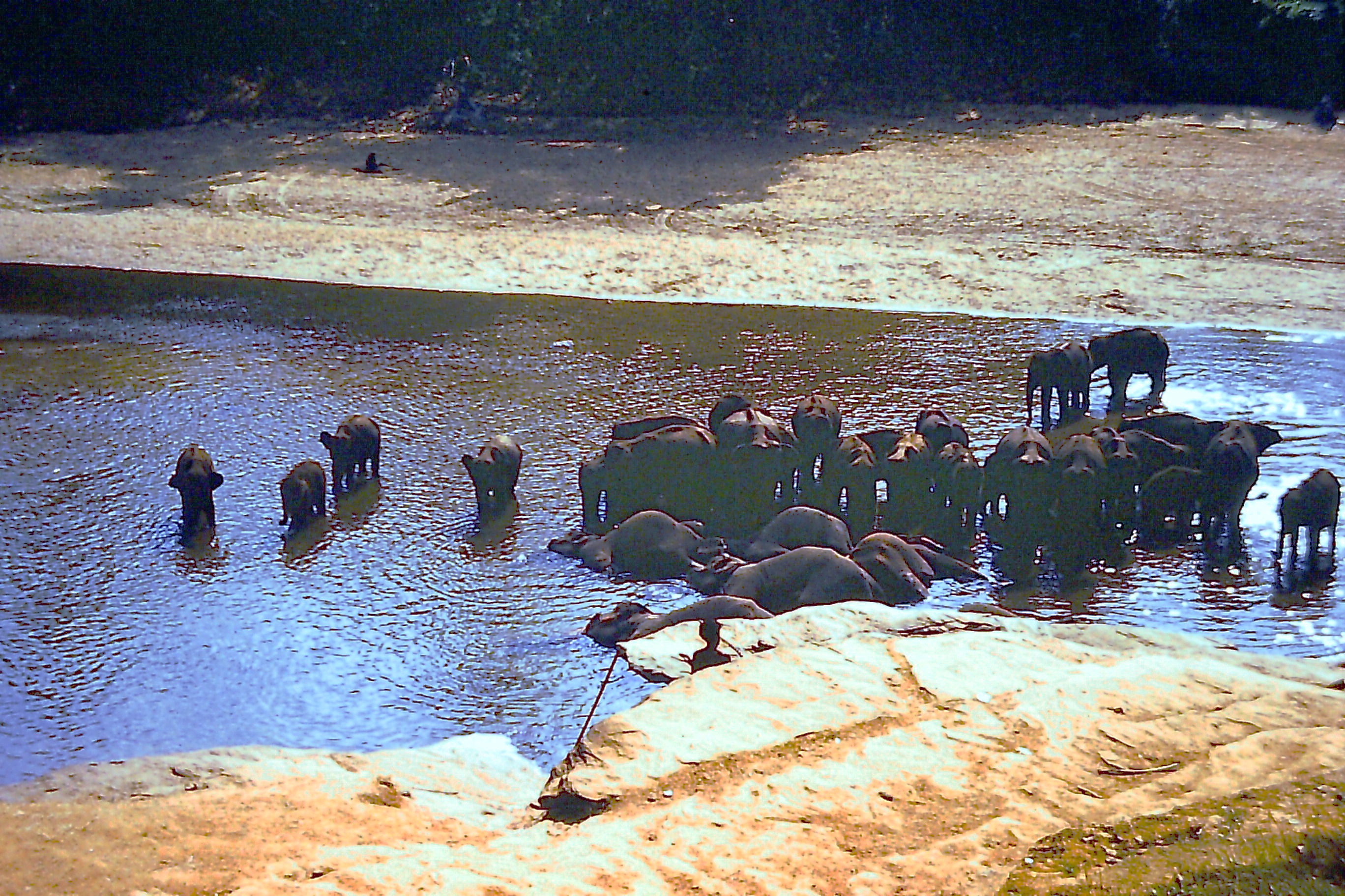
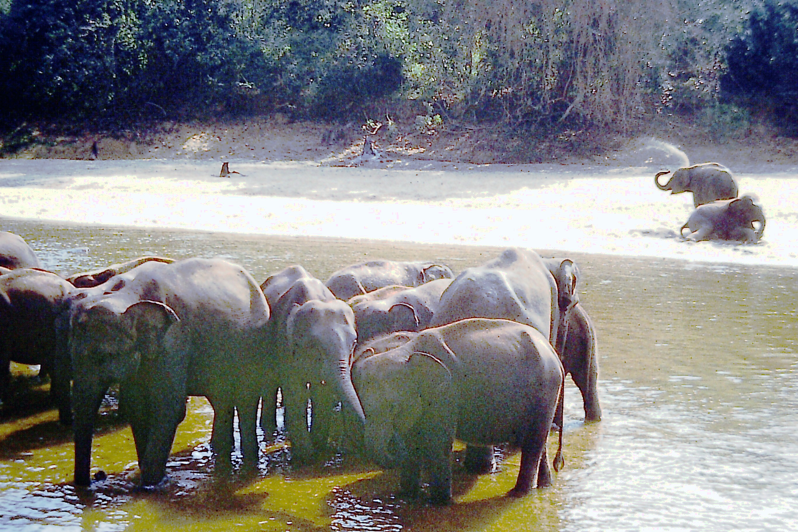
As the downstream settlement projects are implemented, the mammals are displaced and move into remaining forest habitats in the surrounding areas. Displaced animals entering these habitats causes overcrowding. Imbalances in the natural ecosystems may result in a decrease in wildlife populations. Damage to paddy and other crops by displaced elephants have increased since the accelerated downstream development [3,10]. Water holes in the Wilpattu National Park have been improved to increase the carrying capacity [2,9]. About seven protected wildlife reserves have been declared covering a land area of over 230,000 hectares. These reserves have varying degrees of protection, from strict nature reserves to wildlife corridors. Encroachment of forest land in the settlement System and the Flood Plain National Park, is a persistent problem [29].
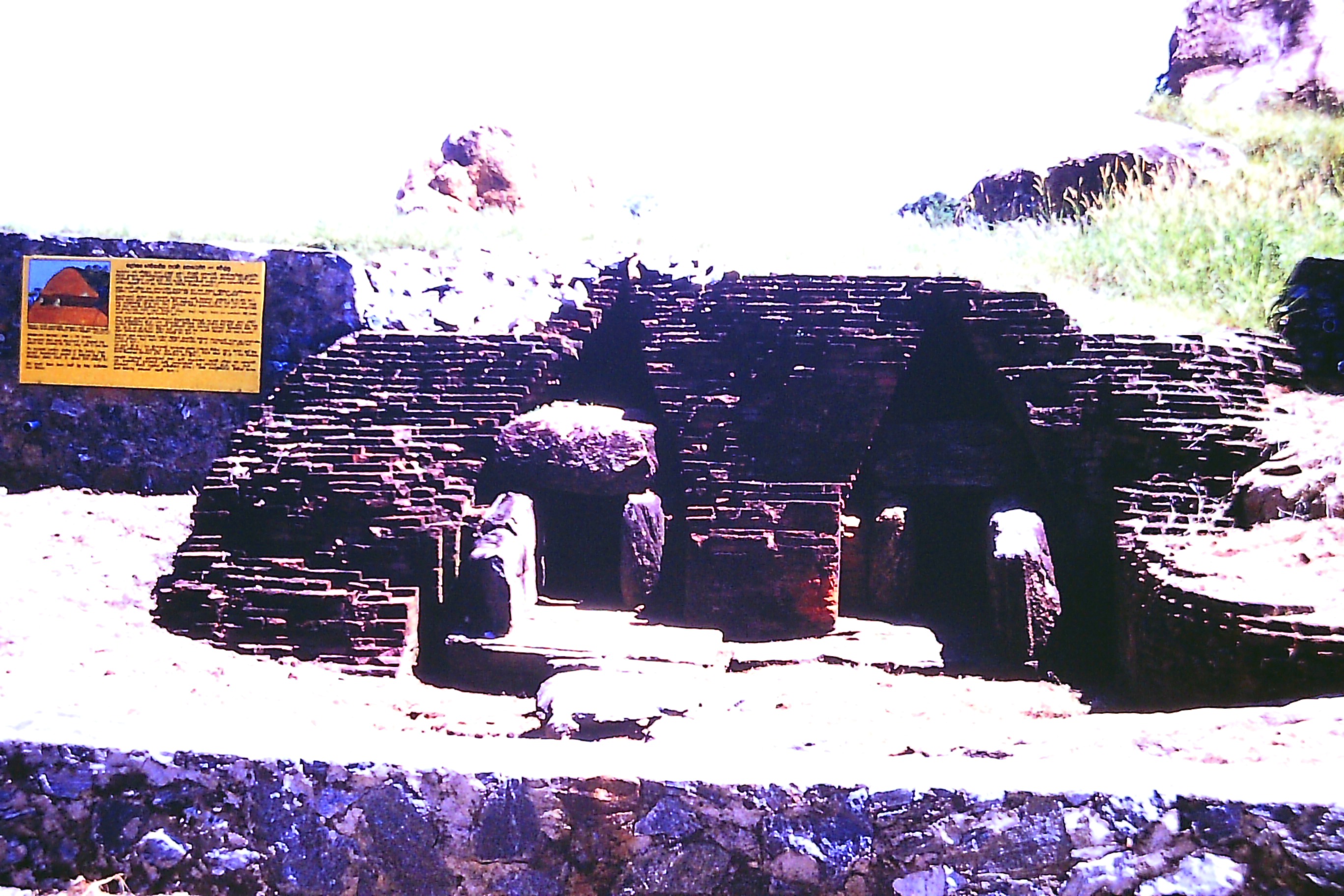
There is potential for tourism development in Victoria, Randenigala, and Maduru Oya reservoirs with wildlife attractions at Maduru Oya. Archaeological remains in the project areas are benefitted by the development; action has been taken to preserve and exhibit them. New roads have been constructed to re-route the stretches of inundated roads, and a new road link on the left bank of the mahaweli River facilitated by the Victoria Dam. There are signs of neglect of old highway infrastructure in the upper catchment that could be attributed to continuing civil unrest in the country. Modern road links have been constructed to remote settlement regions.
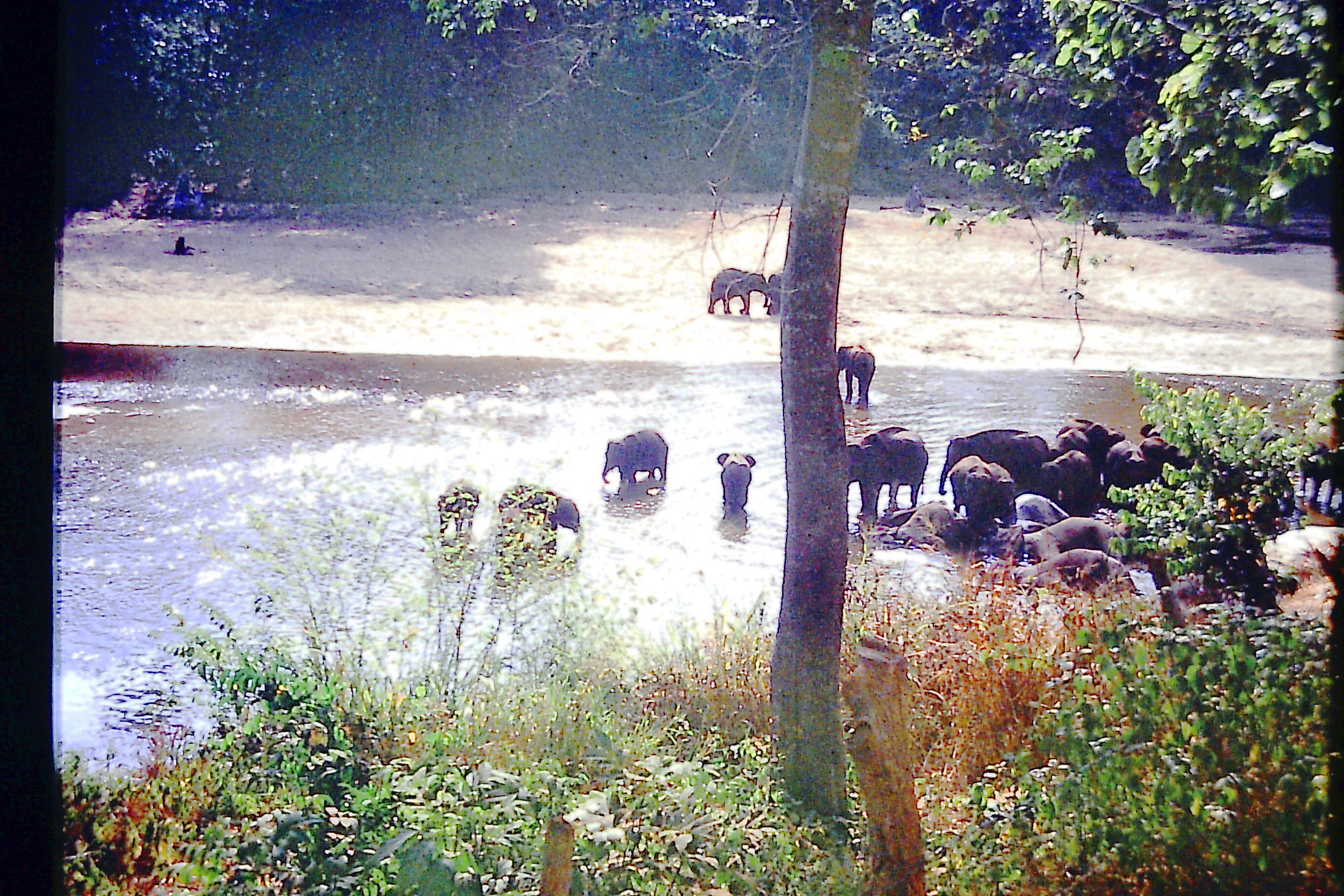
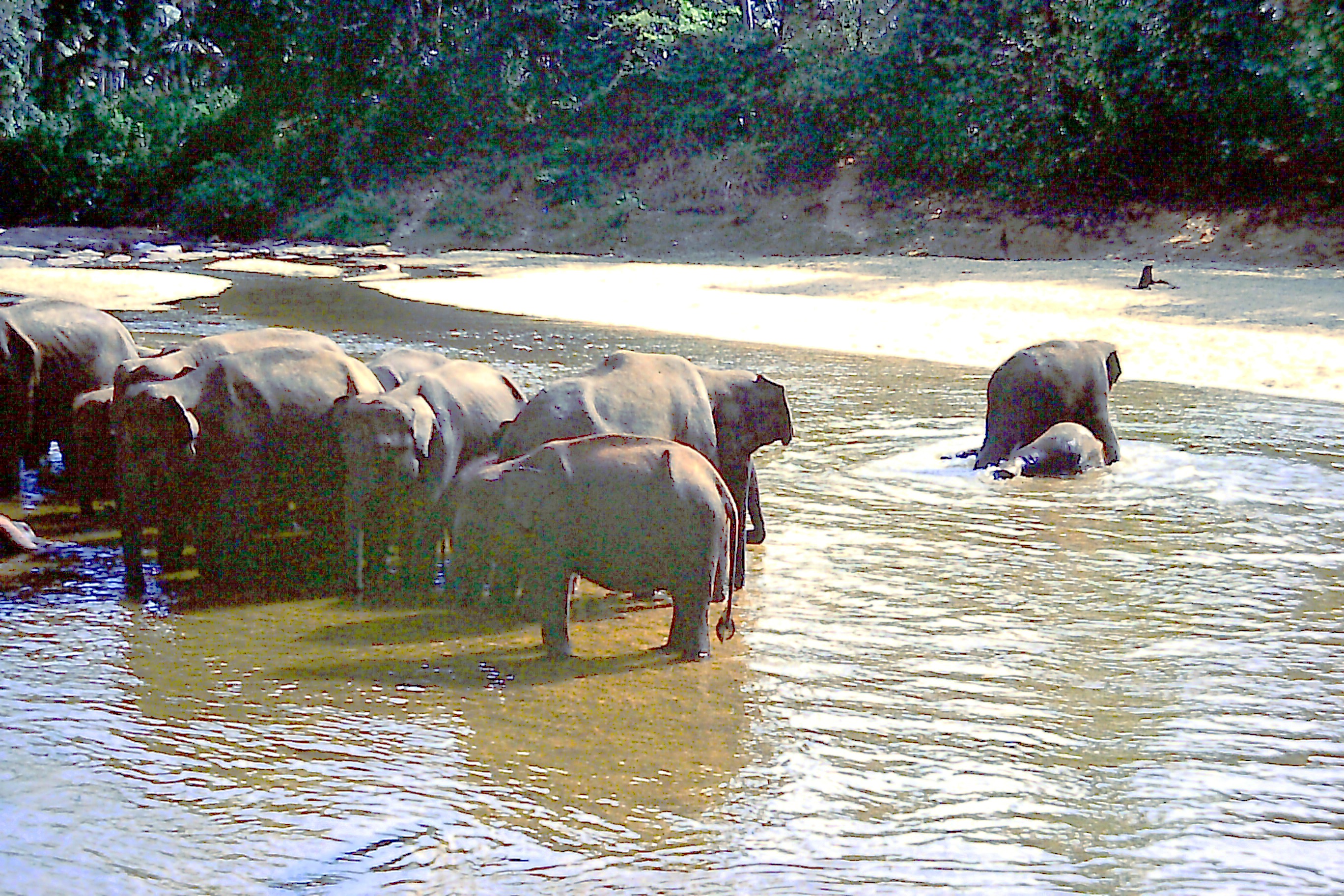
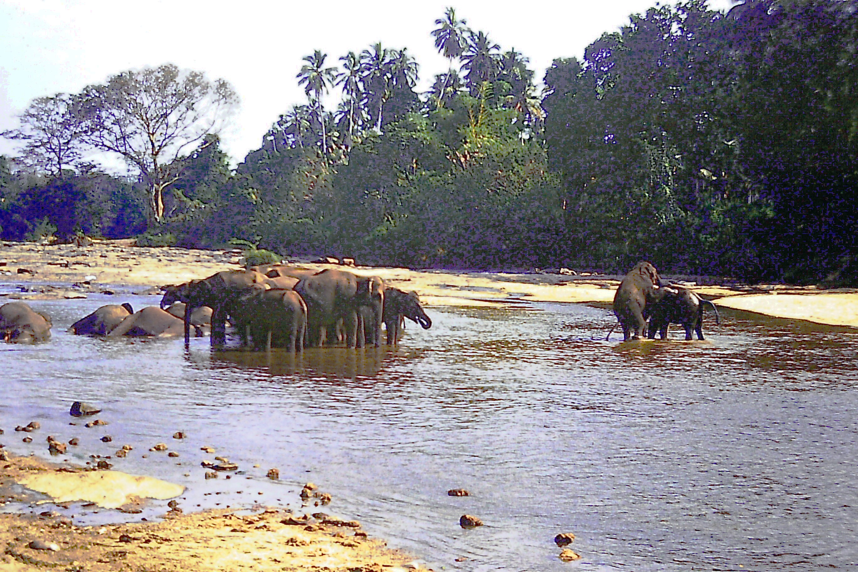
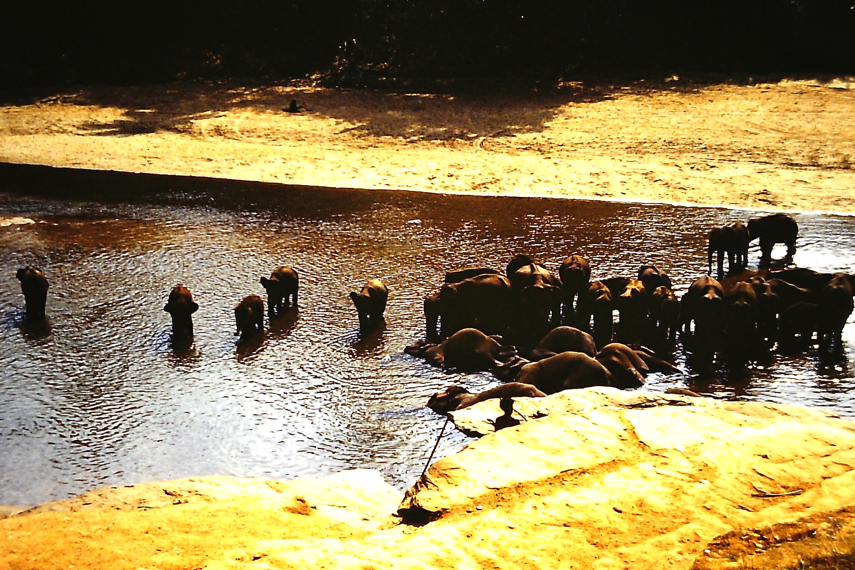
Fig 13. Pinnawela Elephant Orphanage
OPERATIONS
A key issue in the water use of Mahaweli Project is the amount of water diverted at Polgolla Barrage and the amount routed along the Mahaweli Ganga to Victoria and Randenigala. Victoria is treated favourably with regard to the availability of Mahaweli water, because it has better economic returns of water use20. Mahaweli Project has more than doubled the power generation capacity of the country with an increased capacity of 600MW. The augmentation facility has changed the mean water level of the large reservoirs augmented by Mahaweli, attributed to the operational easement provisions available. Illustration (Fig 2) depicts the Mahaweli operations network.
CONCLUSIONS
As a result of political impetus, the major headworks and other infrastructure of the Mahaweli Development Project were implemented during the period 1981 – 1990 under an accelerated programme, with bilateral and multilateral aid.
Engineering geology of the upper catchment of Mahaweli is problematic and its adverse effects have aggravated the construction of the Kotmale Dam. Microseismic activity has been monitored with clusters of magnitude less than 2 Richter scale recorded adjacent to Victoria reservoir, and in the Maduru Oya region distributed on Systems B and C. An increase of microseismic activity due to impoundment of large dams has not occurred.
The river ecosystem in the upper catchment has been replaced with a deep reservoir ecosystem. A programme of soil conservation, planned vegetation, and reforestation to protect the Mahaweli upper catchment is being implemented.
In the Mahaweli distribution system, more water is routed through Victoria along Mahaweli cascade, which is deemed as the favourable economic operational policy. Contemporaneous with downstream flood prevention, the flood plain Villus could be affected by hydrosere succession.
Mahaweli Project provides irrigation with increased reliability to a large area of existing and new lands in the dry zone. The Mahaweli Project lands exhibit sustained green environment in contrast to irrigation schemes in the dry zone which are not fed by Mahaweli waters. Some effects of salinity have been reported in the Kalawewa basin under the System H area. All in all the health conditions in the Mahaweli settlements are not much different to the rest of the country.
The agricultural developments of the Mahaweli Project have cleared a vast area of forest land in the dry zone and destroyed wildlife habitats. Repercussive damage to cultivations by elephants has increased. The downstream forest environment has been replaced with an irrigated agricultural environment beneficial to humans, rich in aquatic resources and lush vegetation. New wildlife parks have been established. The Mahaweli Project has not caused an extinction of species of fauna and flora, but caused environmental disturbances which contribute to a reduction in endangered species populations.
ACKNOWLEDGEMENTS
The author is grateful to the Minister of Lands, Irrigation and Mahaweli Development, Mr P Dayaratne, and the Mahaweli Authority of Sri Lanka, for their kind permission to research for this paper. Grateful acknowledgements are also due to other institutions and officials for assisting with the field visits and enquiries. The author gratefully appreciates the publications and other works listed in the references, on which this paper is based.
REFERENCES
1. Karunatilake, H.N.S. The Accelerated Mahaweli Programme and its Impact. Centre for Demographic and Socio-economic Studies, Sri Lanka. 1988.
2. Vistas of Mahweli. Newsletter of the Mahaweli Centre of the Mahaweli Authority of Sri Lanka. Vol.5, No. 3, 6. March 1990
3. Ibid, Vol. 5, No. 2, February 1990.
4. Acclerated Mahaweli Programme. A summary report, Mahaweli Authority of Sri Lanka. Undated.
5. Brown, K. Kotmale – the dam that moves. Construction News magazine. Vol. 8, No, 8, p 18-25, 1982.
6. Gosschalk, E.M. and Dr.Kulasinghe, A.N.S. Kotmale Dam and Observations on CFRD. Proceedings of a Symposium sponsored by the ASCE, Concrete Face Rockfill Dams. Detroit p 379-395, 1985.
7. Sir William Halcrow and Partners. Kotmale Hydropower Project. Technical brochure.
8. Vitanage, Bulankulama, Adikaram, and Madduma Bandara, Victoria Dam and its Impact. A seminar held at Hotel Hantana, Kandy, Sri Lanka. 1986.
9. Final Report on Kotmale Microseismic Studies, Sri Lanka. Department of Earthquake Engineering, University of Roorkee, U.P. India 1984.
10. USAID. Environmental Assessment, Mahaweli Development Programme, Ministry of Mahaaweli Development, Colombo, Vol. 1. 1980.
11. Ibid. Terrestrial Environment. Vol. II.
12. Ibid. Aquatic Environment, Vol. III.
13. Ibid. Human Environment. Vol. IV.
14. Acres International Ltd. Organisational Aspects, Mahaweli Water Resources Management Project, Water Management Secretariat, Colombo, Canadian International Development Agency, Canada. 1984.
15. Ibid. Studies of Operating Policy Options, Main Report, 1985.
16. Ibid. Policy Studies Briefing Document, Appendix I.
17. Ibid. Irrigation Water Requirements, Appendix II.
18. Ibid. Basic Data, Appendix III.
19. Ibid. Acres Reservoir Simulation Programme, Appendix IV.
20. Ibid. Economic Aspects of Water Use, Appendix V.
21. Handawela, H., A study on inland salinity in Mahaweli System H area, Mahaweli Authority of Sri Lanka, undated.
22. Gunawardhana, H.D., Kumudini, A.M., and Adikari, R., Studies on the quality of irrigation waters in Kalawewa area, University of Colombo, J. Natn. Sci. Coun Sri Lanka, 9(2) p 121-148, 1981
23. Joint WHO/FAO/UNEP, panel of experts on environmental management for vector control. Proceedings of the workshop on irrigation and vector-borne disease transmission, International Irrigation Management Institute, Sri Lanka. 1986.
24. Dr. Wijesundara, M. Daily News, Sri Lanka, Friday, April 6 1990. p 15
25. Patrick, W.K. Primary health care in the Mahaweli, UNICEF sponsored health education bureau publication. 1983
26. Dr. Nichalson, A, et al, Aid in Confidence, Report on an Overseas Development Ministry Health Mission to Sri Lanka. 1978.
27. Johanson, D. Kotmale Environment, Swedish International Development Authority Evaluation Report, SIDA, Stockholm.
28. National Institute of Business Studies Management, Evaluation of the Project, Social development benefitting children and women in System H of Mahaweli development area, Colombo. 1989.
29. Dr. Sobczak, M.T., Mahaweli Environmental Update, USAID, Colombo.
Appendix
System H of Mahaweli Development Project, USAID.
http://pdf.usaid.gov/pdf_docs/PNAAT993.pdf
Mahaweli Projects & Programme 1983 Schematic map of Mahaweli irrigation settlements
http://pdf.usaid.gov/pdf_docs/PDAAX272.pdf
Mahaweli water management to maximise benefits
http://publications.iwmi.org/pdf/H023566.pdf
The Mahaweli Strategy of Sri Lanka — Great Expectation of a Small Nation. C. M. Madduma Bandara
http://link.springer.com/chapter/10.1007%2F978-94-009-5458-8_27